Kendale Lakes night lights from space
Night Light of Kendale Lakes (Florida) from space (United States) Src. Average luminocity for 10x10km area is 98.9205% and for 50x50km: 49.6335%.
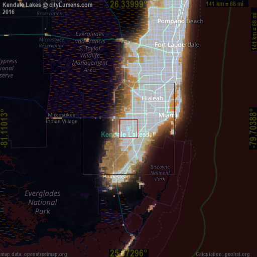
Analysis of Kendale Lakes night lights 2016
Square area 10x10 km:
 73.11%
90-99
24.24%80-89
0.38%70-79
1.52%60-69
0.76%50-59
0%40-49
0%30-39
0%20-29
0%10-19
0%0-9
0%Square area 50x50 km:
24.47%90-99
8.67%80-89
2.38%70-79
2.86%60-69
8.56%50-59
4.62%40-49
3.47%30-39
3.06%20-29
3.48%10-19
5.09%0-9
33.33%Clear (daylight) street map image can be seen on geolist.org.
Map coordinates:
26° 20' 24" North, 81° 6' 36.5" West
25° 42' 29.4" North, 80° 24' 25.2" West
25° 4' 22.7" North, 79° 42' 14" West
Some cities around Kendale Lakes sort by population:
• Tamiami
5.7 km =3.5 mi,  8°
8°
• The Hammocks
5.5 km =3.4 mi,  222°
222°
• University Park
5.8 km =3.6 mi,  42°
42°
• The Crossings
4.2 km =2.6 mi,  172°
172°
• Sweetwater
7 km =4.3 mi,  28°
28°
• Sunset
5.5 km =3.4 mi,  92°
92°
• Olympia Heights
5.6 km =3.5 mi,  68°
68°
• Westwood Lake
4.2 km =2.6 mi,  55°
55°
4160705 (p: 56,148)
Sources (retrieved 2019-11-25):
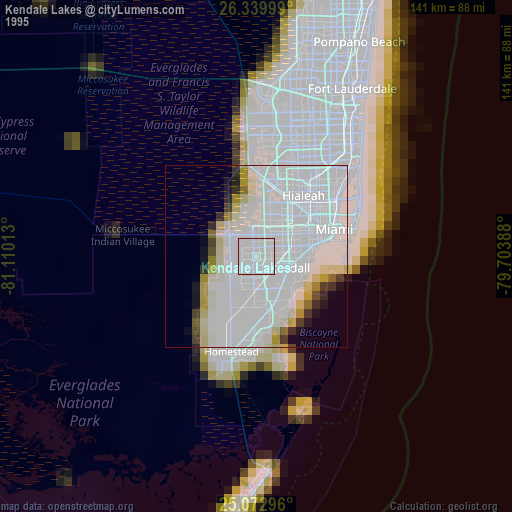
» NASA, Earths city lights 1995
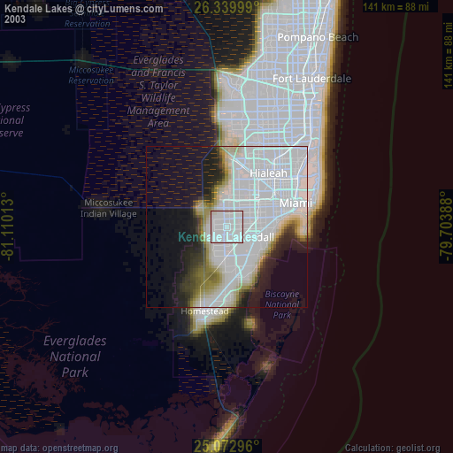
» NASA city lights 2003
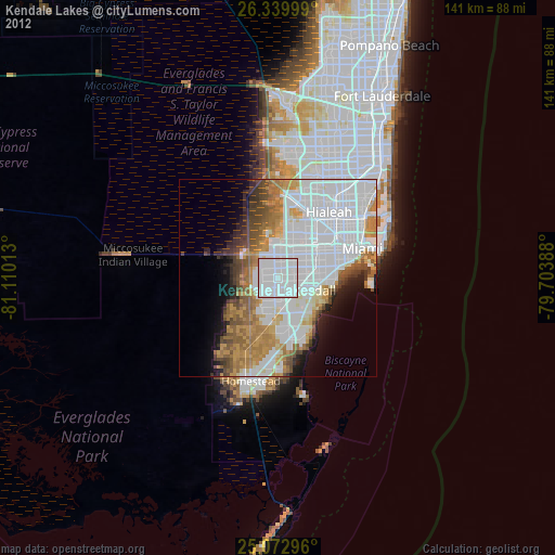
» Earth at Night: Flat Maps 2012, 2016