Tamiami night lights from space
Night Light of Tamiami (Florida) from space (United States) Src. Average luminocity for 10x10km area is 95.3447% and for 50x50km: 52.9787%.
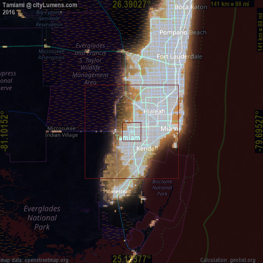
Analysis of Tamiami night lights 2016
Square area 10x10 km:
 64.96%
90-99
22.16%80-89
0%70-79
3.79%60-69
7.77%50-59
1.33%40-49
0%30-39
0%20-29
0%10-19
0%0-9
0%Square area 50x50 km:
27.75%90-99
9.46%80-89
2.22%70-79
3.09%60-69
7.83%50-59
4.34%40-49
3.36%30-39
3.03%20-29
3.55%10-19
4.7%0-9
30.66%Clear (daylight) street map image can be seen on geolist.org.
Map coordinates:
26° 23' 25" North, 81° 6' 5.5" West
25° 45' 31.4" North, 80° 23' 54.2" West
25° 7' 25.6" North, 79° 41' 43" West
Some cities around Tamiami sort by population:
• Fountainebleau
5.3 km =3.3 mi,  72°
72°
• Kendale Lakes
5.7 km =3.5 mi,  188°
188°
• Kendall West
7.1 km =4.4 mi,  214°
214°
• Westchester
7.1 km =4.4 mi,  93°
93°
• University Park
3.4 km =2.1 mi,  113°
113°
• Sweetwater
2.6 km =1.6 mi,  78°
78°
• Olympia Heights
5.6 km =3.5 mi,  129°
129°
• Westwood Lake
4.2 km =2.6 mi,  141°
141°
4174744 (p: 55,271)
Sources (retrieved 2019-11-25):
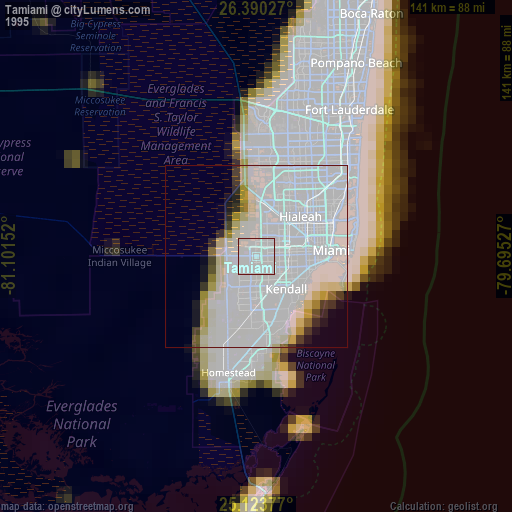
» NASA, Earths city lights 1995
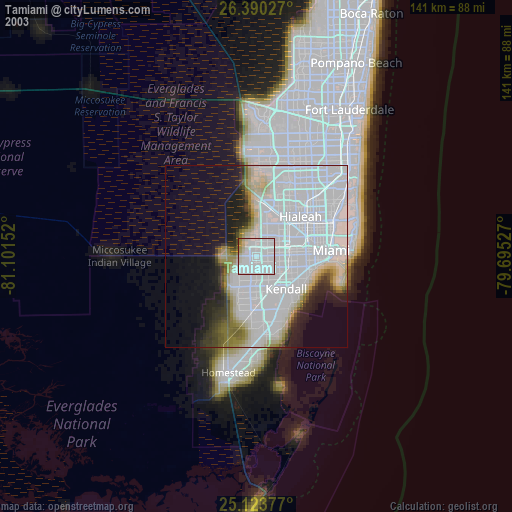
» NASA city lights 2003
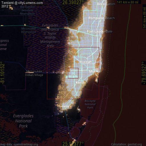
» Earth at Night: Flat Maps 2012, 2016