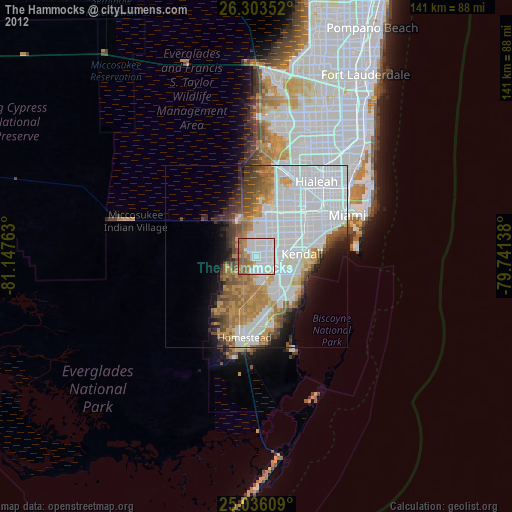
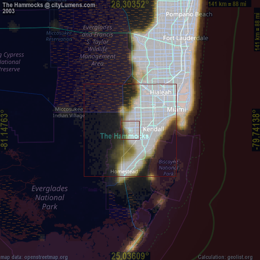
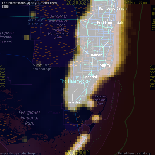
The Hammocks night lights from space
Night Light of The Hammocks (Florida) from space (United States) Src. Average luminocity for 10x10km area is 86.2633% and for 50x50km: 44.5249%.
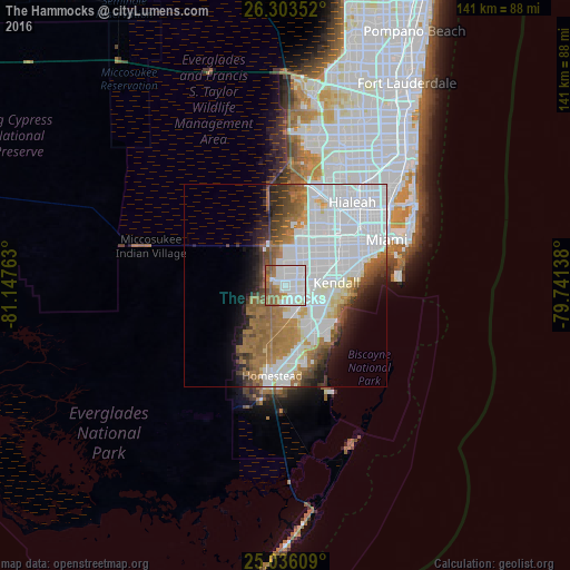
Analysis of The Hammocks night lights 2016
Square area 10x10 km:
 39.39%
90-99
25.38%80-89
2.46%70-79
2.65%60-69
16.48%50-59
11.74%40-49
1.89%30-39
0%20-29
0%10-19
0%0-9
0%Square area 50x50 km:
21.31%90-99
7.85%80-89
2.27%70-79
1.81%60-69
8.26%50-59
4.54%40-49
3.36%30-39
3.03%20-29
3.44%10-19
5.37%0-9
38.76%Clear (daylight) street map image can be seen on geolist.org.
Map coordinates:
26° 18' 12.7" North, 81° 8' 51.5" West
25° 40' 17.4" North, 80° 26' 40.2" West
25° 2' 9.9" North, 79° 44' 29" West
Some cities around The Hammocks sort by population:
• Kendale Lakes
5.5 km =3.4 mi,  42°
42°
• Kendall West
3.9 km =2.4 mi,  8°
8°
• Richmond West
6.9 km =4.3 mi,  167°
167°
• The Crossings
4.3 km =2.7 mi,  91°
91°
• Country Walk
4.3 km =2.7 mi,  163°
163°
• Three Lakes
5.7 km =3.5 mi,  125°
125°
• Westwood Lake
9.6 km =6 mi,  48°
48°
• Richmond Heights
8.8 km =5.5 mi,  120°
120°
4175117 (p: 51,003)
Sources (retrieved 2019-11-25):
» NASA, Earths city lights 1995
» NASA city lights 2003
» Earth at Night: Flat Maps 2012, 2016