Kasson night lights from space
Night Light of Kasson (Minnesota) from space (United States) Src. Average luminocity for 10x10km area is 10.2603% and for 50x50km: 6.8302%.
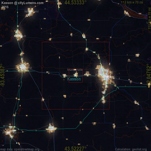
Analysis of Kasson night lights 2016
Square area 10x10 km:
 0.32%
0.32%90-99
1.59%80-89
1.27%70-79
3.33%60-69
0.48%50-59
2.06%40-49
1.11%30-39
0%20-29
0.63%10-19
0%0-9
89.21%Square area 50x50 km:
1.18%90-99
1.11%80-89
1.02%70-79
1.09%60-69
0.73%50-59
0.83%40-49
0.59%30-39
0.69%20-29
1.6%10-19
3.28%0-9
87.87%Clear (daylight) street map image can be seen on geolist.org.
Map coordinates:
44° 31' 60" North, 93° 27' 13.9" West
44° 1' 47.9" North, 92° 45' 2.7" West
43° 31' 20.2" North, 92° 2' 51.4" West
Some cities around Kasson sort by population:
• Rochester
22.5 km =14 mi,  92°
92°
• Owatonna
38.4 km =23.9 mi,  278°
278°
• Austin
44.2 km =27.5 mi,  203°
203°
• Faribault
50.8 km =31.6 mi,  305°
305°
• Northfield
57.8 km =35.9 mi,  325°
325°
• Stewartville
28.6 km =17.8 mi,  132°
132°
• Byron
8.4 km =5.2 mi, 87°
• Lake City
60.5 km =37.6 mi,  39°
39°
5032920 (p: 6,123)
Sources (retrieved 2019-11-25):
» Earth at Night: Flat Maps 2012, 2016