Faribault night lights from space
Night Light of Faribault (Minnesota) from space (United States) Src. Average luminocity for 10x10km area is 32.0924% and for 50x50km: 5.8219%.
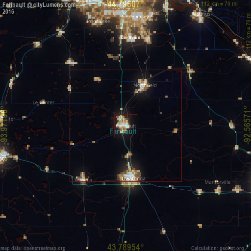
Analysis of Faribault night lights 2016
Square area 10x10 km:
 3.79%
3.79%90-99
6.06%80-89
7.42%70-79
4.85%60-69
2.27%50-59
4.55%40-49
1.82%30-39
1.82%20-29
5.61%10-19
31.21%0-9
30.61%Square area 50x50 km:
0.66%90-99
0.94%80-89
0.8%70-79
0.77%60-69
0.89%50-59
0.74%40-49
0.71%30-39
0.45%20-29
1.02%10-19
4.43%0-9
88.59%Clear (daylight) street map image can be seen on geolist.org.
Map coordinates:
44° 47' 45.9" North, 93° 58' 19.1" West
44° 17' 41.9" North, 93° 16' 7.8" West
43° 47' 22.3" North, 92° 33' 56.6" West
Some cities around Faribault sort by population:
• Lakeville
39.5 km =24.5 mi,  3°
3°
• Apple Valley
48.8 km =30.3 mi, 4°
• Owatonna
23.7 km =14.7 mi,  171°
171°
• Prior Lake
48.1 km =29.9 mi,  345°
345°
• Farmington
39.7 km =24.7 mi,  14°
14°
• Northfield
20.1 km =12.5 mi,  25°
25°
• Waseca
30.7 km =19.1 mi,  218°
218°
• New Prague
36.8 km =22.9 mi,  318°
318°
5026291 (p: 23,650)
Sources (retrieved 2019-11-25):
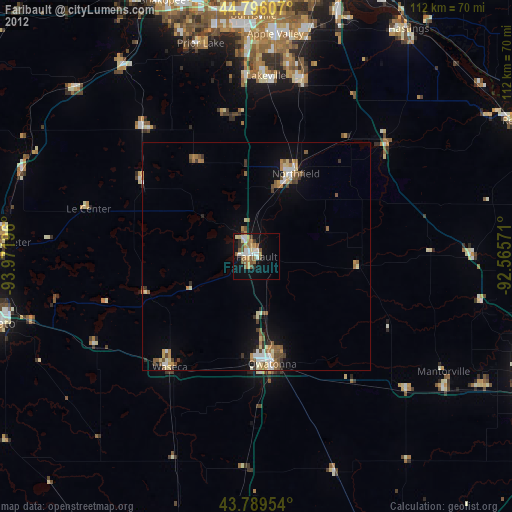
» Earth at Night: Flat Maps 2012, 2016