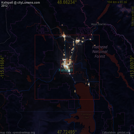
Kalispell night lights from space
Night Light of Kalispell (Montana) from space (United States) Src. Average luminocity for 10x10km area is 30.9851% and for 50x50km: 2.4883%.
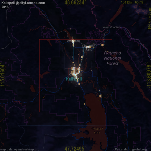
Analysis of Kalispell night lights 2016
Square area 10x10 km:
 4.91%
4.91%90-99
5.8%80-89
2.08%70-79
3.72%60-69
3.57%50-59
3.72%40-49
6.85%30-39
3.87%20-29
6.7%10-19
28.13%0-9
30.65%Square area 50x50 km:
0.29%90-99
0.42%80-89
0.13%70-79
0.28%60-69
0.33%50-59
0.36%40-49
0.47%30-39
0.35%20-29
0.49%10-19
1.79%0-9
95.08%Clear (daylight) street map image can be seen on geolist.org.
Map coordinates:
48° 39' 44.4" North, 115° 0' 57.7" West
48° 11' 44.8" North, 114° 18' 46.5" West
47° 43' 29.8" North, 113° 36' 35.2" West
Some cities around Kalispell sort by population:
• Missoula
149.1 km =92.6 mi,  170°
170°
• Cranbrook, CA
179.9 km =111.8 mi,  323°
323°
• Sandpoint
166.2 km =103.3 mi,  273°
273°
• Evergreen
4.3 km =2.7 mi,  39°
39°
• Whitefish
24 km =14.9 mi,  355°
355°
• Orchard Homes
149.5 km =92.9 mi, 172°
• Columbia Falls
21.9 km =13.6 mi,  26°
26°
• Fernie, CA
155.2 km =96.4 mi,  339°
339°
5660340 (p: 22,052)
Sources (retrieved 2019-11-25):
» Earth at Night: Flat Maps 2012, 2016