Columbia Falls night lights from space
Night Light of Columbia Falls (Montana) from space (United States) Src. Average luminocity for 10x10km area is 8.4403% and for 50x50km: 2.3818%.
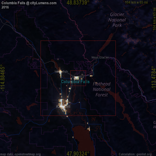
Analysis of Columbia Falls night lights 2016
Square area 10x10 km:
 1.14%
1.14%90-99
1.56%80-89
0.14%70-79
1.14%60-69
1.7%50-59
1.14%40-49
0.43%30-39
1.99%20-29
1.42%10-19
0.43%0-9
88.92%Square area 50x50 km:
0.29%90-99
0.42%80-89
0.13%70-79
0.28%60-69
0.26%50-59
0.3%40-49
0.42%30-39
0.35%20-29
0.53%10-19
1.77%0-9
95.25%Clear (daylight) street map image can be seen on geolist.org.
Map coordinates:
48° 50' 14.6" North, 114° 53' 4.7" West
48° 22' 20.9" North, 114° 10' 53.5" West
47° 54' 11.7" North, 113° 28' 42.2" West
Some cities around Columbia Falls sort by population:
• Missoula
167.4 km =104 mi,  175°
175°
• Kalispell
21.9 km =13.6 mi,  206°
206°
• Cranbrook, CA
170.7 km =106.1 mi,  317°
317°
• Sandpoint
175.7 km =109.2 mi,  266°
266°
• Evergreen
17.7 km =11 mi,  203°
203°
• Whitefish
12.3 km =7.6 mi,  290°
290°
• Orchard Homes
168.1 km =104.5 mi, 176°
• Fernie, CA
141.1 km =87.7 mi,  332°
332°
5645859 (p: 5,093)
Sources (retrieved 2019-11-25):
» Earth at Night: Flat Maps 2012, 2016