Jerome night lights from space
Night Light of Jerome (Idaho) from space (United States) Src. Average luminocity for 10x10km area is 20.9348% and for 50x50km: 5.3051%.
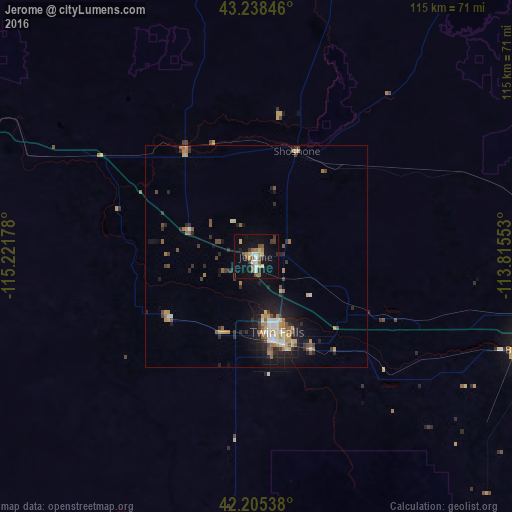
Analysis of Jerome night lights 2016
Square area 10x10 km:
 1.67%
1.67%90-99
2.58%80-89
3.03%70-79
1.82%60-69
4.09%50-59
2.88%40-49
3.03%30-39
4.24%20-29
0.91%10-19
20.76%0-9
55%Square area 50x50 km:
0.48%90-99
0.63%80-89
0.54%70-79
0.76%60-69
0.8%50-59
0.85%40-49
0.7%30-39
0.74%20-29
1.56%10-19
4.05%0-9
88.89%Clear (daylight) street map image can be seen on geolist.org.
Map coordinates:
43° 14' 18.5" North, 115° 13' 18.4" West
42° 43' 26.7" North, 114° 31' 7.1" West
42° 12' 19.4" North, 113° 48' 55.9" West
Some cities around Jerome sort by population:
• Boise
168.7 km =104.8 mi,  305°
305°
• Pocatello
169.9 km =105.6 mi,  84°
84°
• Twin Falls
18.5 km =11.5 mi,  165°
165°
• Chubbuck
168.8 km =104.9 mi, 82°
• Mountain Home
105.7 km =65.7 mi,  295°
295°
• Burley
63 km =39.1 mi,  109°
109°
• Hailey
90 km =55.9 mi,  10°
10°
• Rupert
69.8 km =43.4 mi,  99°
99°
5597034 (p: 11,184)
Sources (retrieved 2019-11-25):
» Earth at Night: Flat Maps 2012, 2016