Burley night lights from space
Night Light of Burley (Idaho) from space (United States) Src. Average luminocity for 10x10km area is 28.8794% and for 50x50km: 2.2692%.
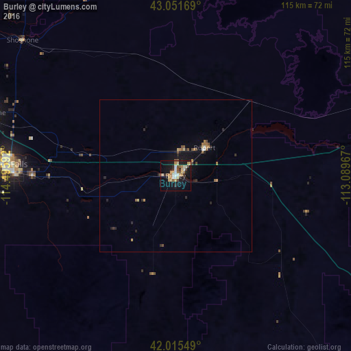
Analysis of Burley night lights 2016
Square area 10x10 km:
 1.75%
1.75%90-99
5.56%80-89
6.67%70-79
4.13%60-69
3.49%50-59
2.38%40-49
3.33%30-39
2.54%20-29
3.49%10-19
32.7%0-9
33.97%Square area 50x50 km:
0.09%90-99
0.27%80-89
0.35%70-79
0.32%60-69
0.31%50-59
0.33%40-49
0.31%30-39
0.19%20-29
0.6%10-19
2%0-9
95.21%Clear (daylight) street map image can be seen on geolist.org.
Map coordinates:
43° 3' 6.1" North, 114° 29' 45.3" West
42° 32' 8.7" North, 113° 47' 34" West
42° 0' 55.8" North, 113° 5' 22.8" West
Some cities around Burley sort by population:
• Pocatello
116.2 km =72.2 mi,  71°
71°
• Twin Falls
54.8 km =34.1 mi,  273°
273°
• Chubbuck
116.5 km =72.4 mi, 68°
• Blackfoot
138.6 km =86.1 mi,  58°
58°
• Jerome
63 km =39.1 mi,  289°
289°
• Tremonton
162.5 km =101 mi,  124°
124°
• Hailey
117.4 km =72.9 mi,  338°
338°
• Rupert
13.2 km =8.2 mi,  45°
45°
5587385 (p: 10,436)
Sources (retrieved 2019-11-25):
» Earth at Night: Flat Maps 2012, 2016