Jennings night lights from space
Night Light of Jennings (Missouri) from space (United States) Src. Average luminocity for 10x10km area is 93.8486% and for 50x50km: 68.6575%.
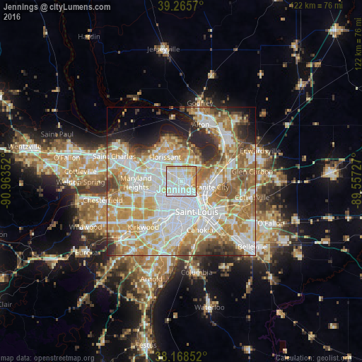
Analysis of Jennings night lights 2016
Square area 10x10 km:
 37.93%
90-99
35.88%80-89
15.31%70-79
10.37%60-69
0.51%50-59
0%40-49
0%30-39
0%20-29
0%10-19
0%0-9
0%Square area 50x50 km:
19.96%90-99
17.05%80-89
9.39%70-79
11.72%60-69
10.03%50-59
6.85%40-49
4.13%30-39
3.46%20-29
5.7%10-19
4.27%0-9
7.44%Clear (daylight) street map image can be seen on geolist.org.
Map coordinates:
39° 15' 56.5" North, 90° 57' 48.7" West
38° 43' 9.2" North, 90° 15' 37.4" West
38° 10' 6.7" North, 89° 33' 26.2" West
Some cities around Jennings sort by population:
• University City
8.2 km =5.1 mi,  211°
211°
• Ferguson
4.8 km =3 mi,  305°
305°
• Bellefontaine Neighbors
3.8 km =2.4 mi,  51°
51°
• Berkeley
7.3 km =4.5 mi,  302°
302°
• Saint Johns
7.2 km =4.5 mi,  264°
264°
• Saint John
7.5 km =4.7 mi,  266°
266°
• Glasgow Village
6.6 km =4.1 mi, 54°
• Dellwood
4 km =2.5 mi,  326°
326°
4392445 (p: 14,819)
Sources (retrieved 2019-11-25):
» Earth at Night: Flat Maps 2012, 2016