Saint Johns night lights from space
Night Light of Saint Johns (Missouri) from space (United States) Src. Average luminocity for 10x10km area is 97.0663% and for 50x50km: 67.002%.
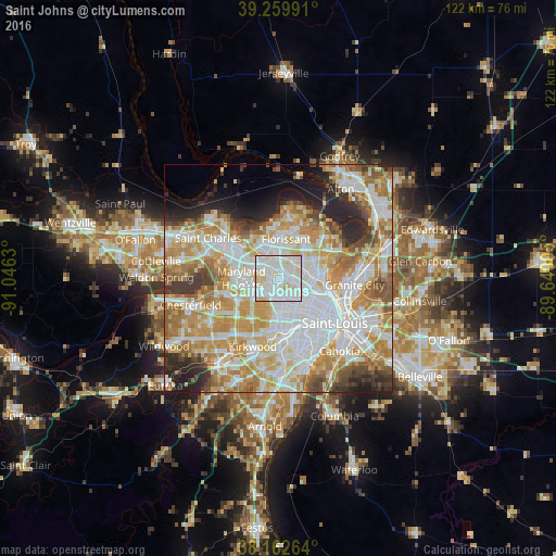
Analysis of Saint Johns night lights 2016
Square area 10x10 km:
 43.2%
43.2%90-99
45.92%80-89
9.86%70-79
1.02%60-69
0%50-59
0%40-49
0%30-39
0%20-29
0%10-19
0%0-9
0%Square area 50x50 km:
19.55%90-99
16.42%80-89
9.25%70-79
11.94%60-69
9.23%50-59
5.86%40-49
3.73%30-39
4.18%20-29
6.6%10-19
4.74%0-9
8.49%Clear (daylight) street map image can be seen on geolist.org.
Map coordinates:
39° 15' 35.7" North, 91° 2' 46.7" West
38° 42' 48.2" North, 90° 20' 35.4" West
38° 9' 45.5" North, 89° 38' 24.2" West
Some cities around Saint Johns sort by population:
• University City
7 km =4.3 mi,  155°
155°
• Hazelwood
6.9 km =4.3 mi,  339°
339°
• Ferguson
4.7 km =2.9 mi,  43°
43°
• Overland
2.1 km =1.3 mi,  230°
230°
• Jennings
7.2 km =4.5 mi,  84°
84°
• Berkeley
4.7 km =2.9 mi,  12°
12°
• Olivette
6.1 km =3.8 mi,  208°
208°
• Dellwood
6.4 km =4 mi,  51°
51°
4406951 (p: 7,690)
Sources (retrieved 2019-11-25):
» Earth at Night: Flat Maps 2012, 2016