Bellefontaine Neighbors night lights from space
Night Light of Bellefontaine Neighbors (Missouri) from space (United States) Src. Average luminocity for 10x10km area is 85.1973% and for 50x50km: 66.5721%.
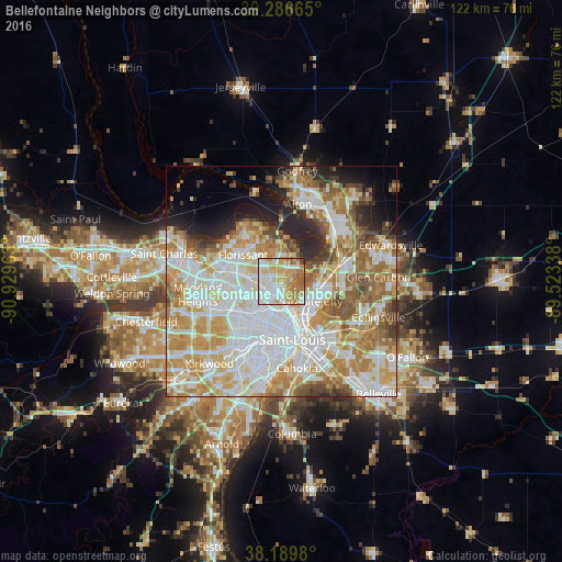
Analysis of Bellefontaine Neighbors night lights 2016
Square area 10x10 km:
 23.47%
90-99
25.34%80-89
15.14%70-79
18.54%60-69
11.56%50-59
4.59%40-49
0.85%30-39
0.51%20-29
0%10-19
0%0-9
0%Square area 50x50 km:
19.43%90-99
16.6%80-89
9.43%70-79
11.03%60-69
9.49%50-59
6.72%40-49
3.88%30-39
2.94%20-29
5.24%10-19
4.99%0-9
10.24%Clear (daylight) street map image can be seen on geolist.org.
Map coordinates:
39° 17' 11.9" North, 90° 55' 46.7" West
38° 44' 25.2" North, 90° 13' 35.4" West
38° 11' 23.3" North, 89° 31' 24.2" West
Some cities around Bellefontaine Neighbors sort by population:
• Granite City
8 km =5 mi,  122°
122°
• Ferguson
6.9 km =4.3 mi,  273°
273°
• Spanish Lake
5.4 km =3.4 mi,  9°
9°
• Jennings
3.8 km =2.4 mi,  231°
231°
• Berkeley
9.2 km =5.7 mi,  279°
279°
• Black Jack
6.9 km =4.3 mi,  329°
329°
• Glasgow Village
2.8 km =1.7 mi,  58°
58°
• Dellwood
5.2 km =3.2 mi, 281°
4376444 (p: 10,798)
Sources (retrieved 2019-11-25):
» Earth at Night: Flat Maps 2012, 2016