Berkeley night lights from space
Night Light of Berkeley (Missouri) from space (United States) Src. Average luminocity for 10x10km area is 96.3078% and for 50x50km: 63.5408%.
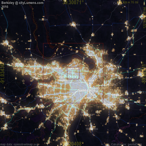
Analysis of Berkeley night lights 2016
Square area 10x10 km:
 42.18%
90-99
42.69%80-89
13.61%70-79
1.53%60-69
0%50-59
0%40-49
0%30-39
0%20-29
0%10-19
0%0-9
0%Square area 50x50 km:
18.93%90-99
15.57%80-89
9.03%70-79
11.26%60-69
8.57%50-59
5.32%40-49
3.16%30-39
3.43%20-29
5.81%10-19
5.04%0-9
13.88%Clear (daylight) street map image can be seen on geolist.org.
Map coordinates:
39° 18' 2.6" North, 91° 2' 3.7" West
38° 45' 16.2" North, 90° 19' 52.4" West
38° 12' 14.7" North, 89° 37' 41.2" West
Some cities around Berkeley sort by population:
• Florissant
3.9 km =2.4 mi,  10°
10°
• Hazelwood
3.9 km =2.4 mi,  298°
298°
• Ferguson
2.5 km =1.6 mi,  117°
117°
• Overland
6.5 km =4 mi,  204°
204°
• Saint Ann
5.4 km =3.4 mi,  236°
236°
• Saint Johns
4.7 km =2.9 mi,  192°
192°
• Saint John
4.6 km =2.9 mi, 196°
• Dellwood
4 km =2.5 mi,  98°
98°
4376623 (p: 9,073)
Sources (retrieved 2019-11-25):
» Earth at Night: Flat Maps 2012, 2016