Indiantown night lights from space
Night Light of Indiantown (Florida) from space (United States) Src. Average luminocity for 10x10km area is 10.1786% and for 50x50km: 10.1551%.
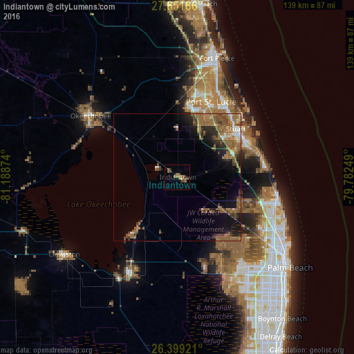
Analysis of Indiantown night lights 2016
Square area 10x10 km:
 0%
0%90-99
0.2%80-89
0.6%70-79
0%60-69
3.97%50-59
5.36%40-49
3.17%30-39
1.79%20-29
0.2%10-19
1.19%0-9
83.53%Square area 50x50 km:
0.51%90-99
0.68%80-89
0.62%70-79
0.55%60-69
4.14%50-59
3.97%40-49
1.82%30-39
1.46%20-29
2.21%10-19
5.06%0-9
78.99%Clear (daylight) street map image can be seen on geolist.org.
Map coordinates:
27° 39' 6.7" North, 81° 11' 19.5" West
27° 1' 38.2" North, 80° 29' 8.2" West
26° 23' 57.2" North, 79° 46' 57" West
Some cities around Indiantown sort by population:
• Port Saint Lucie
32.5 km =20.2 mi,  24°
24°
• The Acreage
33.8 km =21 mi,  140°
140°
• Palm City
26.8 km =16.7 mi,  54°
54°
• Stuart
29.8 km =18.5 mi, 50°
• Hobe Sound
34.8 km =21.6 mi,  84°
84°
• Port Salerno
31.1 km =19.3 mi,  65°
65°
• Pahokee
29.1 km =18.1 mi,  217°
217°
• River Park
34.7 km =21.6 mi, 23°
4159687 (p: 6,083)
Sources (retrieved 2019-11-25):
» Earth at Night: Flat Maps 2012, 2016