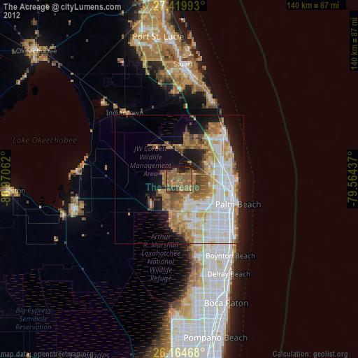
The Acreage night lights from space
Night Light of The Acreage (Florida) from space (United States) Src. Average luminocity for 10x10km area is 46.0496% and for 50x50km: 36.2626%.
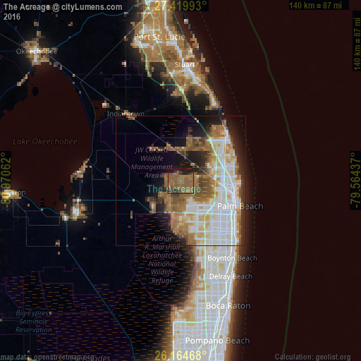
Analysis of The Acreage night lights 2016
Square area 10x10 km:
 0%
0%90-99
0%80-89
0%70-79
0%60-69
15.87%50-59
49.6%40-49
6.75%30-39
6.15%20-29
7.74%10-19
13.89%0-9
0%Square area 50x50 km:
8.3%90-99
8.82%80-89
3.39%70-79
3.02%60-69
7.35%50-59
7.25%40-49
3.9%30-39
2.64%20-29
5.14%10-19
8.5%0-9
41.7%Clear (daylight) street map image can be seen on geolist.org.
Map coordinates:
27° 25' 11.7" North, 80° 58' 14.2" West
26° 47' 38.5" North, 80° 16' 3" West
26° 9' 52.8" North, 79° 33' 51.7" West
Some cities around The Acreage sort by population:
• West Palm Beach
23 km =14.3 mi,  112°
112°
• Wellington
15.3 km =9.5 mi,  170°
170°
• Palm Beach Gardens
13.2 km =8.2 mi,  75°
75°
• Royal Palm Beach
10.2 km =6.3 mi,  158°
158°
• Riviera Beach
20.9 km =13 mi,  95°
95°
• North Palm Beach
18.6 km =11.6 mi, 81°
• Lake Park
20 km =12.4 mi,  87°
87°
• West Gate
19.7 km =12.2 mi,  121°
121°
8096113 (p: 38,704)
Sources (retrieved 2019-11-25):
» Earth at Night: Flat Maps 2012, 2016