Stuart night lights from space
Night Light of Stuart (Florida) from space (United States) Src. Average luminocity for 10x10km area is 71.2538% and for 50x50km: 22.0134%.
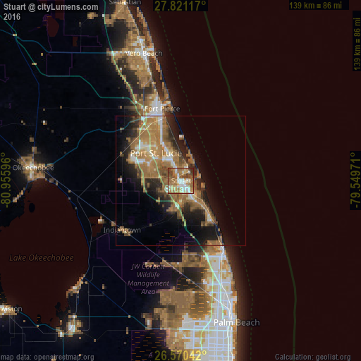
Analysis of Stuart night lights 2016
Square area 10x10 km:
 12.31%
90-99
14.2%80-89
10.8%70-79
10.61%60-69
23.67%50-59
14.58%40-49
6.25%30-39
4.36%20-29
3.22%10-19
0%0-9
0%Square area 50x50 km:
1.87%90-99
2.47%80-89
1.9%70-79
2.68%60-69
9.06%50-59
5.34%40-49
2.77%30-39
2.41%20-29
5.13%10-19
9.52%0-9
56.85%Clear (daylight) street map image can be seen on geolist.org.
Map coordinates:
27° 49' 16.2" North, 80° 57' 21.5" West
27° 11' 51.2" North, 80° 15' 10.2" West
26° 34' 13.5" North, 79° 32' 59" West
Some cities around Stuart sort by population:
• Port Saint Lucie
14.4 km =8.9 mi,  318°
318°
• Palm City
3.6 km =2.2 mi,  201°
201°
• Jensen Beach
6.7 km =4.2 mi,  19°
19°
• Hobe Sound
19.2 km =11.9 mi,  143°
143°
• Port Salerno
7.9 km =4.9 mi, 138°
• Indian River Estates
19.4 km =12.1 mi,  343°
343°
• River Park
16 km =9.9 mi, 324°
• Hutchinson Island South
11.8 km =7.3 mi, 15°
4174201 (p: 16,462)
Sources (retrieved 2019-11-25):
» Earth at Night: Flat Maps 2012, 2016