Port Saint Lucie night lights from space
Night Light of Port Saint Lucie (Florida) from space (United States) Src. Average luminocity for 10x10km area is 75.9811% and for 50x50km: 24.2807%.
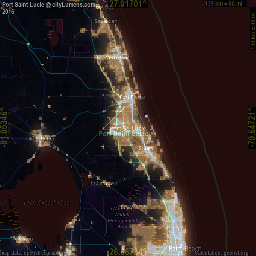
Analysis of Port Saint Lucie night lights 2016
Square area 10x10 km:
 8.71%
8.71%90-99
12.12%80-89
12.12%70-79
25%60-69
39.2%50-59
2.46%40-49
0.38%30-39
0%20-29
0%10-19
0%0-9
0%Square area 50x50 km:
2.44%90-99
3.13%80-89
2.06%70-79
2.84%60-69
9.63%50-59
5.56%40-49
3.25%30-39
2.98%20-29
6.09%10-19
8.2%0-9
53.82%Clear (daylight) street map image can be seen on geolist.org.
Map coordinates:
27° 55' 1.2" North, 81° 3' 12.5" West
27° 17' 38.1" North, 80° 21' 1.2" West
26° 40' 2.4" North, 79° 38' 50" West
Some cities around Port Saint Lucie sort by population:
• Fort Pierce
17.2 km =10.7 mi,  8°
8°
• Palm City
16.3 km =10.1 mi,  149°
149°
• Stuart
14.4 km =8.9 mi,  138°
138°
• Jensen Beach
12.7 km =7.9 mi,  110°
110°
• Indian River Estates
8.8 km =5.5 mi,  27°
27°
• River Park
2.3 km =1.4 mi, 7°
• Hutchinson Island South
12.8 km =8 mi,  87°
87°
• Fort Pierce South
12.9 km =8 mi,  358°
358°
4169171 (p: 164,603)
Sources (retrieved 2019-11-25):
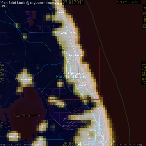
» NASA, Earths city lights 1995
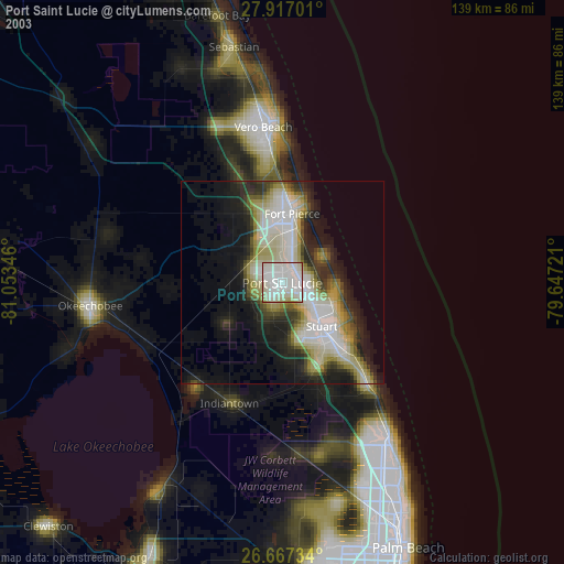
» NASA city lights 2003
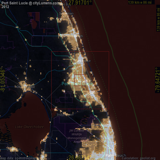
» Earth at Night: Flat Maps 2012, 2016