Independence night lights from space
Night Light of Independence (Kansas) from space (United States) Src. Average luminocity for 10x10km area is 20.2364% and for 50x50km: 3.0237%.
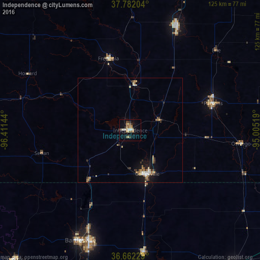
Analysis of Independence night lights 2016
Square area 10x10 km:
 1.87%
1.87%90-99
2.38%80-89
3.91%70-79
2.38%60-69
3.06%50-59
4.08%40-49
0.68%30-39
4.76%20-29
0.34%10-19
13.95%0-9
62.59%Square area 50x50 km:
0.26%90-99
0.32%80-89
0.55%70-79
0.39%60-69
0.46%50-59
0.47%40-49
0.22%30-39
0.67%20-29
0.28%10-19
2.45%0-9
93.94%Clear (daylight) street map image can be seen on geolist.org.
Map coordinates:
37° 46' 55.3" North, 96° 24' 41.2" West
37° 13' 27.3" North, 95° 42' 29.9" West
36° 39' 44.2" North, 95° 0' 18.7" West
Some cities around Independence sort by population:
• Bartlesville
58.3 km =36.2 mi,  204°
204°
• Pittsburg
91.1 km =56.6 mi,  76°
76°
• Miami
83.4 km =51.8 mi,  117°
117°
• Parsons
41.6 km =25.8 mi,  71°
71°
• Coffeyville
22.3 km =13.9 mi,  158°
158°
• Chanute
55.2 km =34.3 mi,  23°
23°
• Vinita
81.6 km =50.7 mi,  142°
142°
• Iola
82.5 km =51.3 mi, 19°
4273359 (p: 8,958)
Sources (retrieved 2019-11-25):
» Earth at Night: Flat Maps 2012, 2016