Vinita night lights from space
Night Light of Vinita (Oklahoma) from space (United States) Src. Average luminocity for 10x10km area is 22.707% and for 50x50km: 2.8507%.
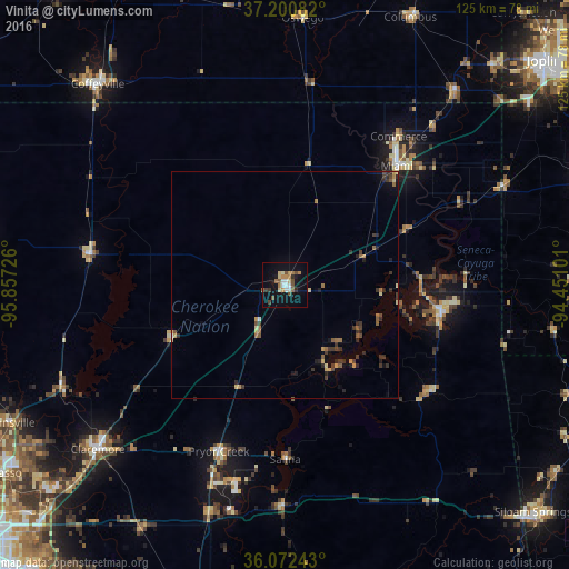
Analysis of Vinita night lights 2016
Square area 10x10 km:
 2.38%
2.38%90-99
3.11%80-89
3.3%70-79
2.93%60-69
3.85%50-59
2.2%40-49
4.58%30-39
2.38%20-29
0.73%10-19
18.86%0-9
55.68%Square area 50x50 km:
0.11%90-99
0.17%80-89
0.35%70-79
0.43%60-69
0.5%50-59
0.4%40-49
0.5%30-39
0.83%20-29
0.62%10-19
1.13%0-9
94.95%Clear (daylight) street map image can be seen on geolist.org.
Map coordinates:
37° 12' 3" North, 95° 51' 26.1" West
36° 38' 19.3" North, 95° 9' 14.9" West
36° 4' 20.7" North, 94° 27' 3.6" West
Some cities around Vinita sort by population:
• Claremore
55 km =34.2 mi,  228°
228°
• Miami
36 km =22.4 mi,  43°
43°
• Coffeyville
60.5 km =37.6 mi,  317°
317°
• Pryor Creek
39.5 km =24.5 mi,  201°
201°
• Pryor
39.5 km =24.5 mi, 201°
• Catoosa
72.8 km =45.2 mi, 226°
• Grove
34.7 km =21.6 mi,  98°
98°
• Collinsville
68.4 km =42.5 mi,  243°
243°
4554496 (p: 5,643)
Sources (retrieved 2019-11-25):
» Earth at Night: Flat Maps 2012, 2016