Hobart night lights from space
Night Light of Hobart (Indiana) from space (United States) Src. Average luminocity for 10x10km area is 58.6156% and for 50x50km: 36.2634%.
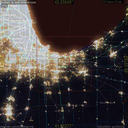
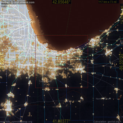
Analysis of Hobart night lights 2016
Square area 10x10 km:
 3.91%
3.91%90-99
5.1%80-89
7.31%70-79
9.35%60-69
26.36%50-59
18.37%40-49
10.88%30-39
7.99%20-29
5.95%10-19
4.76%0-9
0%Square area 50x50 km:
7.55%90-99
6.63%80-89
4.27%70-79
4.73%60-69
6.04%50-59
5.83%40-49
4.8%30-39
4.96%20-29
7.45%10-19
11.5%0-9
36.24%Clear (daylight) street map image can be seen on geolist.org.
Map coordinates:
42° 3' 23.3" North, 87° 57' 29.4" West
41° 31' 56.1" North, 87° 15' 18.1" West
41° 0' 13.6" North, 86° 33' 6.9" West
Some cities around Hobart sort by population:
• Gary
10.2 km =6.3 mi,  311°
311°
• Portage
8.2 km =5.1 mi,  53°
53°
• Merrillville
8.5 km =5.3 mi,  229°
229°
• Griffith
14 km =8.7 mi,  268°
268°
• Lake Station
4.9 km =3 mi,  15°
15°
• Lakes of the Four Seasons
14 km =8.7 mi,  165°
165°
• Winfield
14.2 km =8.8 mi,  186°
186°
• South Haven
9.9 km =6.2 mi,  83°
83°
4921476 (p: 28,404)
Sources (retrieved 2019-11-25):
» Earth at Night: Flat Maps 2012, 2016