El Segundo night lights from space
Night Light of El Segundo (California) from space (United States) Src. Average luminocity for 10x10km area is 72.5927% and for 50x50km: 54.9776%.
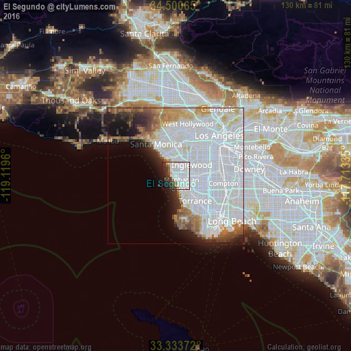
Analysis of El Segundo night lights 2016
Square area 10x10 km:
 41.43%
90-99
18.01%80-89
1.4%70-79
1.05%60-69
2.1%50-59
3.5%40-49
3.67%30-39
9.27%20-29
9.62%10-19
8.04%0-9
1.92%Square area 50x50 km:
33.45%90-99
9.9%80-89
2.49%70-79
2.91%60-69
3.42%50-59
2.81%40-49
2.52%30-39
2.36%20-29
3.74%10-19
5.28%0-9
31.12%Clear (daylight) street map image can be seen on geolist.org.
Map coordinates:
34° 30' 2.3" North, 119° 7' 10.6" West
33° 55' 9" North, 118° 24' 59.3" West
33° 20' 1.4" North, 117° 42' 48.1" West
Some cities around El Segundo sort by population:
• Inglewood
7.5 km =4.7 mi,  51°
51°
• Hawthorne
5.9 km =3.7 mi,  93°
93°
• Manhattan Beach
3.9 km =2.4 mi,  172°
172°
• Lawndale
6.9 km =4.3 mi,  121°
121°
• Lennox
6.3 km =3.9 mi,  70°
70°
• Hermosa Beach
6.5 km =4 mi, 166°
• Del Aire
4.3 km =2.7 mi, 94°
• Marina del Rey
7.5 km =4.7 mi,  334°
334°
5345860 (p: 17,037)
Sources (retrieved 2019-11-25):
» Earth at Night: Flat Maps 2012, 2016