Lawndale night lights from space
Night Light of Lawndale (California) from space (United States) Src. Average luminocity for 10x10km area is 99.1696% and for 50x50km: 60.3056%.

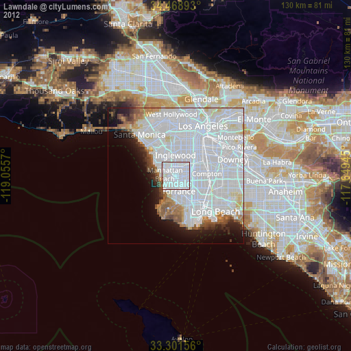
Analysis of Lawndale night lights 2016
Square area 10x10 km:
 79.37%
90-99
18.53%80-89
1.05%70-79
0.7%60-69
0.35%50-59
0%40-49
0%30-39
0%20-29
0%10-19
0%0-9
0%Square area 50x50 km:
37.8%90-99
12.73%80-89
2.46%70-79
1.65%60-69
2.85%50-59
2.4%40-49
1.97%30-39
2.08%20-29
3.76%10-19
5.46%0-9
26.86%Clear (daylight) street map image can be seen on geolist.org.
Map coordinates:
34° 28' 8.1" North, 119° 3' 20.5" West
33° 53' 14.1" North, 118° 21' 9.3" West
33° 18' 5.6" North, 117° 38' 58" West
Some cities around Lawndale sort by population:
• Hawthorne
3.2 km =2 mi,  0°
0°
• Redondo Beach
5.4 km =3.4 mi,  218°
218°
• Gardena
4 km =2.5 mi,  88°
88°
• Manhattan Beach
5.4 km =3.4 mi,  267°
267°
• Lennox
5.7 km =3.5 mi,  359°
359°
• Hermosa Beach
5.1 km =3.2 mi,  237°
237°
• Del Aire
3.6 km =2.2 mi,  334°
334°
• Alondra Park
2 km =1.2 mi,  82°
82°
5365603 (p: 33,430)
Sources (retrieved 2019-11-25):
» Earth at Night: Flat Maps 2012, 2016