Durham night lights from space
Night Light of Durham (North Carolina) from space (United States) Src. Average luminocity for 10x10km area is 93.5128% and for 50x50km: 42.8768%.
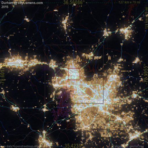
Analysis of Durham night lights 2016
Square area 10x10 km:
 41.21%
90-99
31.5%80-89
13.74%70-79
10.99%60-69
2.56%50-59
0%40-49
0%30-39
0%20-29
0%10-19
0%0-9
0%Square area 50x50 km:
8.43%90-99
8.61%80-89
7.87%70-79
7.41%60-69
7.64%50-59
3.39%40-49
2.85%30-39
4.7%20-29
6.06%10-19
14.04%0-9
29%Clear (daylight) street map image can be seen on geolist.org.
Map coordinates:
36° 33' 39.1" North, 79° 36' 6.3" West
35° 59' 38.5" North, 78° 53' 55" West
35° 25' 23.2" North, 78° 11' 43.8" West
Some cities around Durham sort by population:
• West Raleigh
31.3 km =19.4 mi,  137°
137°
• Cary
24.9 km =15.5 mi,  154°
154°
• Chapel Hill
16.8 km =10.4 mi,  237°
237°
• Apex
29.4 km =18.3 mi,  171°
171°
• Morrisville
20.1 km =12.5 mi,  160°
160°
• Carrboro
18.4 km =11.4 mi, 239°
• Butner
20 km =12.4 mi,  39°
39°
• Hillsborough
20.2 km =12.6 mi,  296°
296°
4464368 (p: 257,636)
Sources (retrieved 2019-11-25):
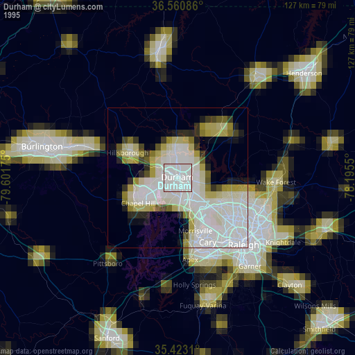
» NASA, Earths city lights 1995
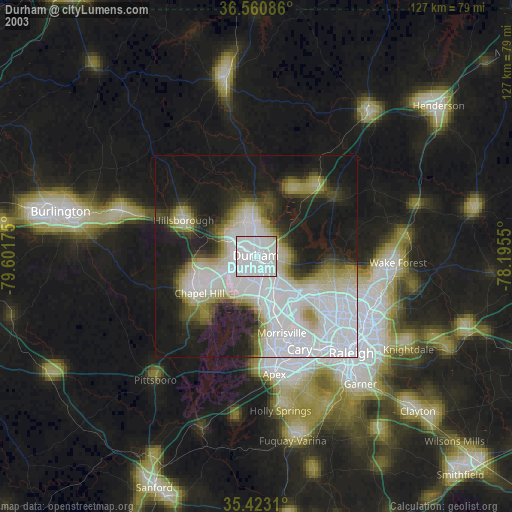
» NASA city lights 2003
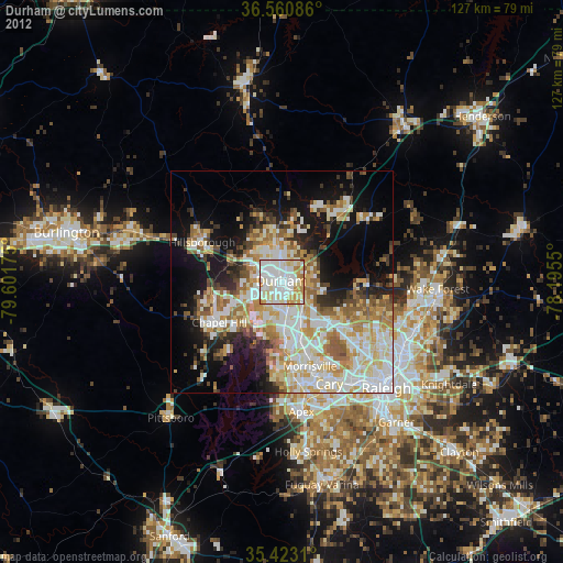
» Earth at Night: Flat Maps 2012, 2016