Roxboro night lights from space
Night Light of Roxboro (North Carolina) from space (United States) Src. Average luminocity for 10x10km area is 34.4755% and for 50x50km: 2.984%.
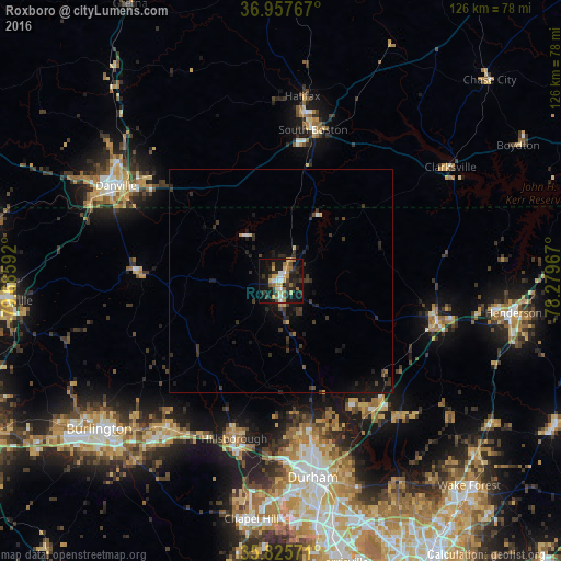
Analysis of Roxboro night lights 2016
Square area 10x10 km:
 2.8%
2.8%90-99
4.2%80-89
5.42%70-79
6.64%60-69
6.64%50-59
3.5%40-49
2.8%30-39
6.47%20-29
11.54%10-19
35.66%0-9
14.34%Square area 50x50 km:
0.15%90-99
0.21%80-89
0.34%70-79
0.34%60-69
0.32%50-59
0.2%40-49
0.37%30-39
1.26%20-29
1.2%10-19
3.1%0-9
92.51%Clear (daylight) street map image can be seen on geolist.org.
Map coordinates:
36° 57' 27.6" North, 79° 41' 9.3" West
36° 23' 37.5" North, 78° 58' 58" West
35° 49' 32.6" North, 78° 16' 46.8" West
Some cities around Roxboro sort by population:
• Durham
45.1 km =28 mi,  170°
170°
• Danville
42.6 km =26.5 mi,  300°
300°
• Graham
52 km =32.3 mi,  226°
226°
• Mebane
41.8 km =26 mi,  217°
217°
• Oxford
36.3 km =22.6 mi,  104°
104°
• South Boston
34.7 km =21.6 mi,  12°
12°
• Butner
35.5 km =22.1 mi,  145°
145°
• Hillsborough
36.9 km =22.9 mi,  196°
196°
4489200 (p: 8,334)
Sources (retrieved 2019-11-25):
» Earth at Night: Flat Maps 2012, 2016