Hauppauge night lights from space
Night Light of Hauppauge (New York) from space (United States) Src. Average luminocity for 10x10km area is 82.5663% and for 50x50km: 42.3297%.
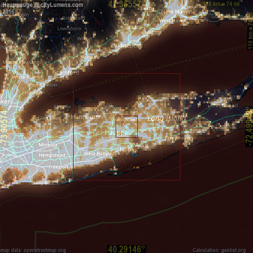
Analysis of Hauppauge night lights 2016
Square area 10x10 km:
 17.01%
90-99
23.81%80-89
14.46%70-79
20.92%60-69
17.18%50-59
5.95%40-49
0.68%30-39
0%20-29
0%10-19
0%0-9
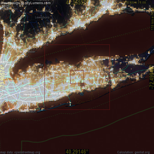
0%Square area 50x50 km:
7.98%90-99
9.38%80-89
6.22%70-79
8.49%60-69
7.61%50-59
5.94%40-49
3.44%30-39
2.51%20-29
5.57%10-19
8.83%0-9
34.02%Clear (daylight) street map image can be seen on geolist.org.
Map coordinates:
41° 21' 20.1" North, 73° 54' 20.7" West
40° 49' 32.3" North, 73° 12' 9.4" West
40° 17' 29.3" North, 72° 29' 58.2" West
Some cities around Hauppauge sort by population:
• Brentwood
6.2 km =3.9 mi,  216°
216°
• Commack
7.8 km =4.8 mi,  284°
284°
• Central Islip
3.9 km =2.4 mi,  178°
178°
• Smithtown
3.4 km =2.1 mi,  2°
2°
• Lake Ronkonkoma
6.1 km =3.8 mi,  80°
80°
• Ronkonkoma
7.7 km =4.8 mi,  98°
98°
• Nesconset
5 km =3.1 mi,  54°
54°
• Saint James
7.1 km =4.4 mi,  33°
33°
5120228 (p: 20,882)
Sources (retrieved 2019-11-25):
» Earth at Night: Flat Maps 2012, 2016