Hartsdale night lights from space
Night Light of Hartsdale (New York) from space (United States) Src. Average luminocity for 10x10km area is 81.4099% and for 50x50km: 58.2391%.
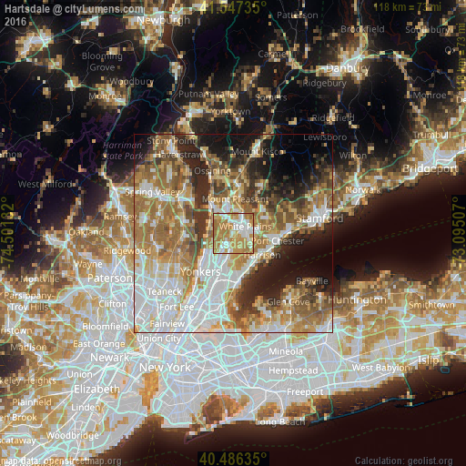
Analysis of Hartsdale night lights 2016
Square area 10x10 km:
 17.01%
90-99
20.07%80-89
7.99%70-79
28.91%60-69
24.83%50-59
1.19%40-49
0%30-39
0%20-29
0%10-19
0%0-9
0%Square area 50x50 km:
14.3%90-99
11.63%80-89
6.61%70-79
8.81%60-69
12.3%50-59
8.28%40-49
5.79%30-39
5.47%20-29
8.01%10-19
9.28%0-9
9.53%Clear (daylight) street map image can be seen on geolist.org.
Map coordinates:
41° 32' 50.5" North, 74° 30' 4.8" West
41° 1' 8.4" North, 73° 47' 53.5" West
40° 29' 10.9" North, 73° 5' 42.3" West
Some cities around Hartsdale sort by population:
• Greenburgh
4.1 km =2.5 mi,  292°
292°
• White Plains
3.4 km =2.1 mi,  60°
60°
• Eastchester
6.8 km =4.2 mi,  187°
187°
• Scarsdale
1.9 km =1.2 mi,  143°
143°
• Dobbs Ferry
6.3 km =3.9 mi,  265°
265°
• Hastings-on-Hudson
7.3 km =4.5 mi,  248°
248°
• Greenville
3.4 km =2.1 mi,  212°
212°
• Irvington
6.3 km =3.9 mi, 290°
5120141 (p: 5,293)
Sources (retrieved 2019-11-25):
» Earth at Night: Flat Maps 2012, 2016