Harrisburg night lights from space
Night Light of Harrisburg (North Carolina) from space (United States) Src. Average luminocity for 10x10km area is 77.1667% and for 50x50km: 55.065%.
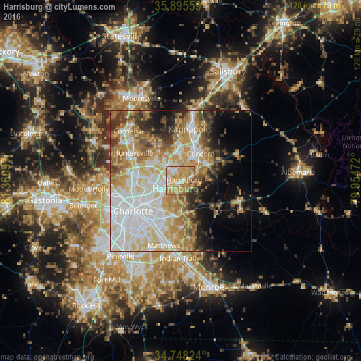
Analysis of Harrisburg night lights 2016
Square area 10x10 km:
 9.52%
9.52%90-99
10.62%80-89
23.81%70-79
31.87%60-69
14.84%50-59
3.85%40-49
1.83%30-39
2.2%20-29
1.47%10-19
0%0-9
0%Square area 50x50 km:
14.13%90-99
11.74%80-89
10.41%70-79
8.92%60-69
8.24%50-59
4.09%40-49
3.94%30-39
5.54%20-29
4.89%10-19
7.8%0-9
20.3%Clear (daylight) street map image can be seen on geolist.org.
Map coordinates:
35° 53' 44.1" North, 81° 21' 39.5" West
35° 19' 26.2" North, 80° 39' 28.2" West
34° 44' 53.7" North, 79° 57' 17" West
Some cities around Harrisburg sort by population:
• Charlotte
20 km =12.4 mi,  237°
237°
• Concord
11.7 km =7.3 mi,  36°
36°
• Huntersville
19.3 km =12 mi,  299°
299°
• Kannapolis
18.5 km =11.5 mi,  10°
10°
• Matthews
23.8 km =14.8 mi,  194°
194°
• Cornelius
25.8 km =16 mi,  314°
314°
• Mint Hill
16.1 km =10 mi,  176°
176°
• Davidson
25.8 km =16 mi,  320°
320°
4470109 (p: 14,539)
Sources (retrieved 2019-11-25):
» Earth at Night: Flat Maps 2012, 2016