Cornelius night lights from space
Night Light of Cornelius (North Carolina) from space (United States) Src. Average luminocity for 10x10km area is 65.6502% and for 50x50km: 48.4023%.
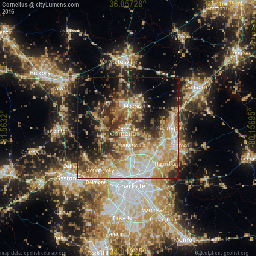
Analysis of Cornelius night lights 2016
Square area 10x10 km:
 10.62%
90-99
10.81%80-89
12.45%70-79
10.44%60-69
15.02%50-59
10.07%40-49
9.89%30-39
18.32%20-29
2.38%10-19
0%0-9
0%Square area 50x50 km:
6.9%90-99
7.54%80-89
9.71%70-79
9.79%60-69
9.14%50-59
5.95%40-49
5.41%30-39
8.04%20-29
9.12%10-19
10.17%0-9
18.22%Clear (daylight) street map image can be seen on geolist.org.
Map coordinates:
36° 3' 26.2" North, 81° 33' 47.5" West
35° 29' 12.5" North, 80° 51' 36.3" West
34° 54' 44.1" North, 80° 9' 25" West
Some cities around Cornelius sort by population:
• Concord
26.7 km =16.6 mi,  108°
108°
• Huntersville
8.6 km =5.3 mi,  169°
169°
• Kannapolis
21.6 km =13.4 mi,  89°
89°
• Mooresville
11.8 km =7.3 mi,  22°
22°
• Harrisburg
25.8 km =16 mi,  134°
134°
• Mount Holly
25.3 km =15.7 mi,  213°
213°
• Davidson
2.6 km =1.6 mi,  47°
47°
• Lake Norman of Catawba
14.3 km =8.9 mi,  321°
321°
4461941 (p: 28,092)
Sources (retrieved 2019-11-25):
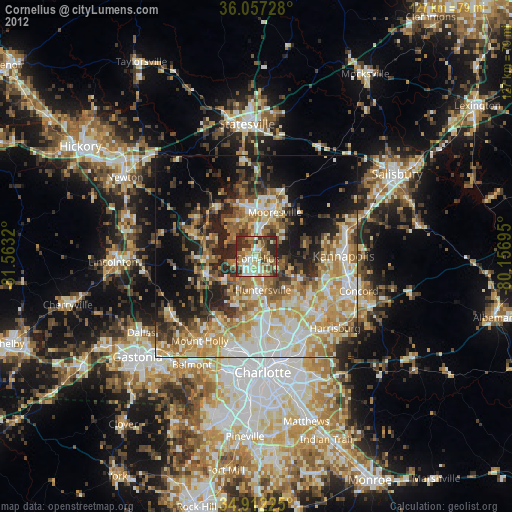
» Earth at Night: Flat Maps 2012, 2016