Charlotte night lights from space
Night Light of Charlotte (North Carolina) from space (United States) Src. Average luminocity for 10x10km area is 99.7133% and for 50x50km: 74.0207%.
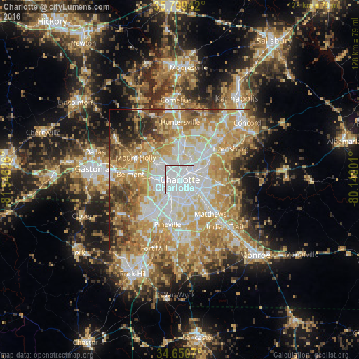

Analysis of Charlotte night lights 2016
Square area 10x10 km:
 85.84%
90-99
14.16%80-89
0%70-79
0%60-69
0%50-59
0%40-49
0%30-39
0%20-29
0%10-19
0%0-9
0%Square area 50x50 km:
17.66%90-99
15.64%80-89
15.57%70-79
15.18%60-69
12.97%50-59
5.77%40-49
4.94%30-39
4.66%20-29
4.14%10-19
2.53%0-9
0.95%Clear (daylight) street map image can be seen on geolist.org.
Map coordinates:
35° 47' 57.9" North, 81° 32' 46.5" West
35° 13' 37.5" North, 80° 50' 35.3" West
34° 39' 2.5" North, 80° 8' 24" West
Some cities around Charlotte sort by population:
• Huntersville
20.4 km =12.7 mi,  0°
0°
• Matthews
16.4 km =10.2 mi,  138°
138°
• Mint Hill
18.6 km =11.6 mi,  106°
106°
• Stallings
20.8 km =12.9 mi, 136°
• Harrisburg
20 km =12.4 mi,  57°
57°
• Mount Holly
17.6 km =10.9 mi,  296°
296°
• Belmont
17.7 km =11 mi,  275°
275°
• Pineville
16.6 km =10.3 mi,  195°
195°
4460243 (p: 827,097)
Sources (retrieved 2019-11-25):
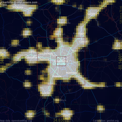
» NASA, Earths city lights 1995
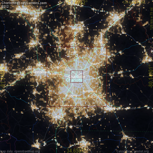
» NASA city lights 2003
» Earth at Night: Flat Maps 2012, 2016