Huntersville night lights from space
Night Light of Huntersville (North Carolina) from space (United States) Src. Average luminocity for 10x10km area is 75.4853% and for 50x50km: 60.2191%.
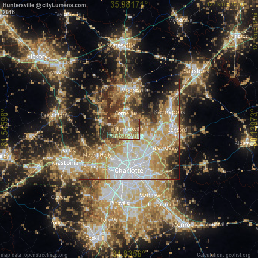
Analysis of Huntersville night lights 2016
Square area 10x10 km:
 10.07%
90-99
12.82%80-89
16.48%70-79
21.06%60-69
21.61%50-59
12.45%40-49
4.95%30-39
0.55%20-29
0%10-19
0%0-9
0%Square area 50x50 km:
12.74%90-99
10.15%80-89
11.89%70-79
11.39%60-69
10.97%50-59
6.4%40-49
5.69%30-39
7.36%20-29
8.46%10-19
7.77%0-9
7.18%Clear (daylight) street map image can be seen on geolist.org.
Map coordinates:
35° 58' 54.2" North, 81° 32' 45.5" West
35° 24' 38.5" North, 80° 50' 34.3" West
34° 50' 8.2" North, 80° 8' 23" West
Some cities around Huntersville sort by population:
• Charlotte
20.4 km =12.7 mi,  180°
180°
• Kannapolis
21.8 km =13.5 mi,  66°
66°
• Mooresville
19.6 km =12.2 mi,  8°
8°
• Cornelius
8.6 km =5.3 mi,  349°
349°
• Harrisburg
19.3 km =12 mi,  119°
119°
• Mount Holly
20.1 km =12.5 mi,  231°
231°
• Davidson
10.2 km =6.3 mi,  1°
1°
• Lake Norman of Catawba
22.2 km =13.8 mi,  331°
331°
4472370 (p: 52,704)
Sources (retrieved 2019-11-25):
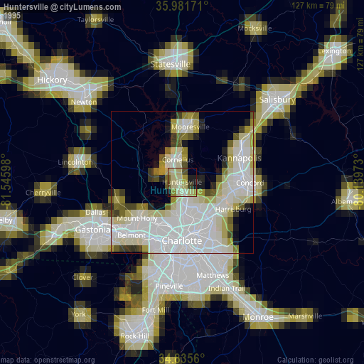
» NASA, Earths city lights 1995
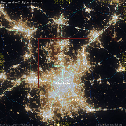
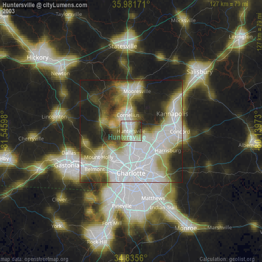
» NASA city lights 2003
» Earth at Night: Flat Maps 2012, 2016