Gustine night lights from space
Night Light of Gustine (California) from space (United States) Src. Average luminocity for 10x10km area is 7.0272% and for 50x50km: 6.4089%.
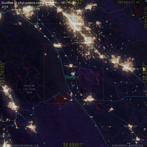
Analysis of Gustine night lights 2016
Square area 10x10 km:
 0%
0%90-99
0.68%80-89
0%70-79
2.72%60-69
0.68%50-59
1.36%40-49
0%30-39
2.04%20-29
1.36%10-19
0.68%0-9
90.48%Square area 50x50 km:
0.39%90-99
0.59%80-89
0.33%70-79
1.21%60-69
0.83%50-59
1.17%40-49
1.31%30-39
1.79%20-29
1.61%10-19
5.27%0-9
85.5%Clear (daylight) street map image can be seen on geolist.org.
Map coordinates:
37° 48' 55" North, 121° 42' 7" West
37° 15' 27.8" North, 120° 59' 55.8" West
36° 41' 45.6" North, 120° 17' 44.5" West
Some cities around Gustine sort by population:
• Turlock
29.6 km =18.4 mi,  27°
27°
• Los Banos
25.8 km =16 mi,  149°
149°
• Patterson
26.4 km =16.4 mi,  334°
334°
• Livingston
28.3 km =17.6 mi,  59°
59°
• Newman
6.5 km =4 mi,  342°
342°
• Delhi
27.5 km =17.1 mi,  45°
45°
• Keyes
34 km =21.1 mi,  12°
12°
• Hilmar-Irwin
20.9 km =13 mi,  38°
38°
5354747 (p: 5,756)
Sources (retrieved 2019-11-25):
» Earth at Night: Flat Maps 2012, 2016