Livingston night lights from space
Night Light of Livingston (California) from space (United States) Src. Average luminocity for 10x10km area is 22.4075% and for 50x50km: 14.3379%.
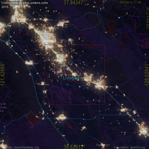
Analysis of Livingston night lights 2016
Square area 10x10 km:
 0.65%
0.65%90-99
1.3%80-89
2.6%70-79
5.52%60-69
1.79%50-59
3.08%40-49
6.82%30-39
5.36%20-29
1.62%10-19
31.98%0-9
39.29%Square area 50x50 km:
1.35%90-99
1.67%80-89
0.8%70-79
2.31%60-69
2.27%50-59
2.42%40-49
3.3%30-39
3.88%20-29
4.94%10-19
9.84%0-9
67.22%Clear (daylight) street map image can be seen on geolist.org.
Map coordinates:
37° 56' 36.5" North, 121° 25' 36" West
37° 23' 12.8" North, 120° 43' 24.7" West
36° 49' 34.1" North, 120° 1' 13.5" West
Some cities around Livingston sort by population:
• Merced
23.3 km =14.5 mi,  113°
113°
• Turlock
16.2 km =10.1 mi,  317°
317°
• Atwater
11 km =6.8 mi, 113°
• Delhi
7 km =4.3 mi, 316°
• Winton
9.7 km =6 mi,  88°
88°
• Hughson
26.5 km =16.5 mi,  331°
331°
• Keyes
25.4 km =15.8 mi, 318°
• Hilmar-Irwin
11.4 km =7.1 mi,  279°
279°
5367427 (p: 13,902)
Sources (retrieved 2019-11-25):
» Earth at Night: Flat Maps 2012, 2016