Greenwood night lights from space
Night Light of Greenwood (Indiana) from space (United States) Src. Average luminocity for 10x10km area is 81.8766% and for 50x50km: 41.1892%.

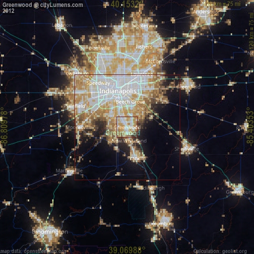
Analysis of Greenwood night lights 2016
Square area 10x10 km:
 20.94%
90-99
25.32%80-89
13.8%70-79
18.51%60-69
8.28%50-59
5.52%40-49
2.11%30-39
3.73%20-29
1.79%10-19
0%0-9
0%Square area 50x50 km:
12%90-99
9.49%80-89
5.05%70-79
5.93%60-69
5.31%50-59
3.88%40-49
3.33%30-39
3.5%20-29
4.91%10-19
8.24%0-9
38.35%Clear (daylight) street map image can be seen on geolist.org.
Map coordinates:
40° 9' 11.5" North, 86° 48' 35.2" West
39° 36' 49.2" North, 86° 6' 23.9" West
39° 4' 11.6" North, 85° 24' 12.7" West
Some cities around Greenwood sort by population:
• Indianapolis
17.8 km =11.1 mi,  345°
345°
• Franklin
15.4 km =9.6 mi,  163°
163°
• Beech Grove
12.1 km =7.5 mi,  6°
6°
• Speedway
25.1 km =15.6 mi,  326°
326°
• Mooresville
22.9 km =14.2 mi,  269°
269°
• Bargersville
11.6 km =7.2 mi,  206°
206°
• New Whiteland
6.3 km =3.9 mi,  171°
171°
• Cumberland
22.1 km =13.7 mi,  35°
35°
4258313 (p: 55,586)
Sources (retrieved 2019-11-25):
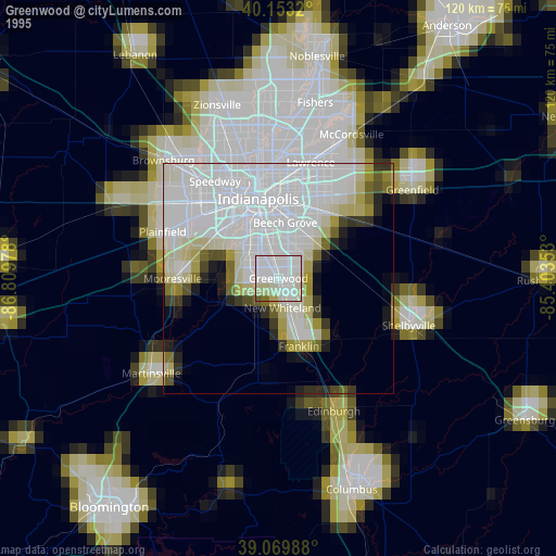
» NASA, Earths city lights 1995
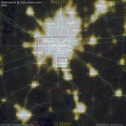
» NASA city lights 2003
» Earth at Night: Flat Maps 2012, 2016