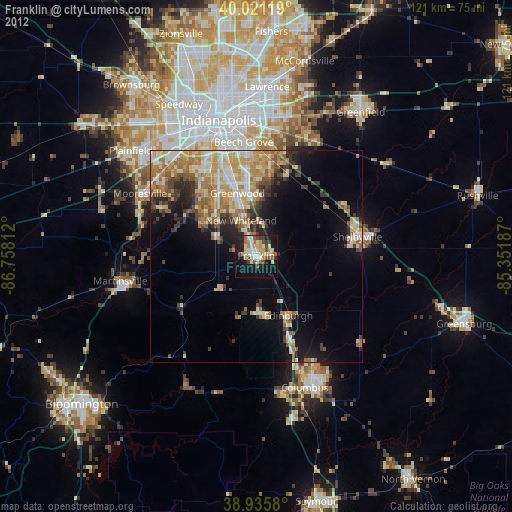
Franklin night lights from space
Night Light of Franklin (Indiana) from space (United States) Src. Average luminocity for 10x10km area is 37.8279% and for 50x50km: 19.3314%.
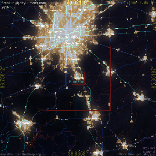
Analysis of Franklin night lights 2016
Square area 10x10 km:
 6.01%
6.01%90-99
6.01%80-89
6.17%70-79
6.17%60-69
5.52%50-59
2.6%40-49
2.6%30-39
4.38%20-29
12.82%10-19
34.09%0-9
13.64%Square area 50x50 km:
2.53%90-99
3.29%80-89
2.78%70-79
3.45%60-69
3.25%50-59
2.77%40-49
2.31%30-39
2.58%20-29
4.32%10-19
9.21%0-9
63.52%Clear (daylight) street map image can be seen on geolist.org.
Map coordinates:
40° 1' 16.3" North, 86° 45' 29.2" West
39° 28' 50.2" North, 86° 3' 18" West
38° 56' 8.9" North, 85° 21' 6.7" West
Some cities around Franklin sort by population:
• Greenwood
15.4 km =9.6 mi,  343°
343°
• Columbus
33.1 km =20.6 mi,  159°
159°
• Shelbyville
24.3 km =15.1 mi,  79°
79°
• Beech Grove
27 km =16.8 mi,  353°
353°
• Martinsville
32.6 km =20.3 mi,  259°
259°
• Mooresville
31.1 km =19.3 mi,  298°
298°
• Bargersville
10.7 km =6.6 mi,  294°
294°
• New Whiteland
9.3 km =5.8 mi, 338°
4828382 (p: 24,598)
Sources (retrieved 2019-11-25):
» Earth at Night: Flat Maps 2012, 2016