Indianapolis night lights from space
Night Light of Indianapolis (Indiana) from space (United States) Src. Average luminocity for 10x10km area is 99.3197% and for 50x50km: 64.0671%.
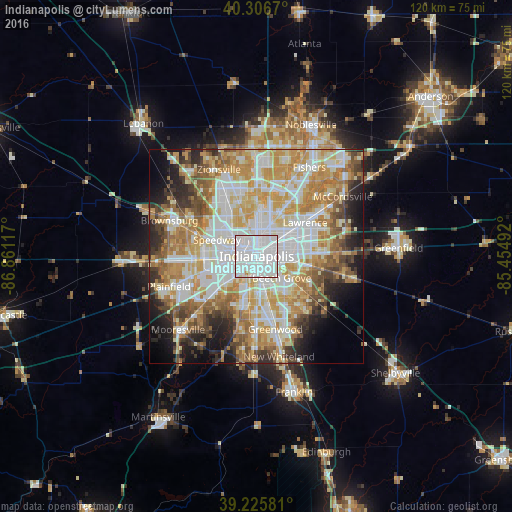
Analysis of Indianapolis night lights 2016
Square area 10x10 km:
 75.17%
90-99
23.81%80-89
0.34%70-79
0.68%60-69
0%50-59
0%40-49
0%30-39
0%20-29
0%10-19
0%0-9
0%Square area 50x50 km:
16.81%90-99
15.11%80-89
9.28%70-79
11.98%60-69
9.03%50-59
6.45%40-49
4.88%30-39
4.68%20-29
6.13%10-19
6.72%0-9
8.94%Clear (daylight) street map image can be seen on geolist.org.
Map coordinates:
40° 18' 24.1" North, 86° 51' 40.2" West
39° 46' 6.2" North, 86° 9' 28.9" West
39° 13' 32.9" North, 85° 27' 17.7" West
Some cities around Indianapolis sort by population:
• Greenwood
17.8 km =11.1 mi,  165°
165°
• Lawrence
13.8 km =8.6 mi,  55°
55°
• Fairfield Heights
20.3 km =12.6 mi,  289°
289°
• Broad Ripple
11 km =6.8 mi,  7°
7°
• Avon
20.7 km =12.9 mi,  268°
268°
• Beech Grove
7.8 km =4.8 mi,  131°
131°
• Speedway
10.1 km =6.3 mi, 291°
• Cumberland
17.2 km =10.7 mi,  87°
87°
4259418 (p: 829,718)
Sources (retrieved 2019-11-25):
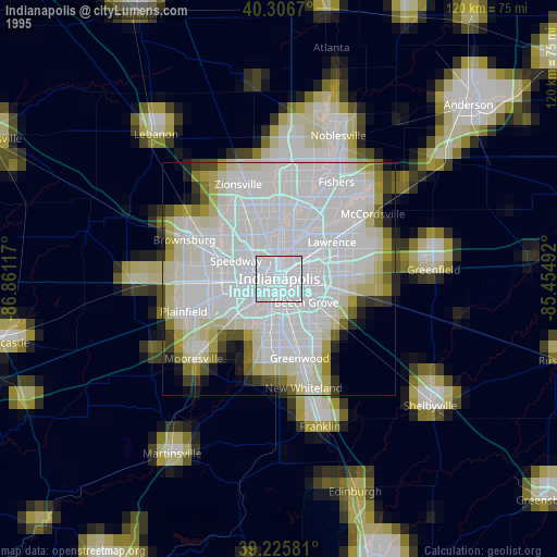
» NASA, Earths city lights 1995
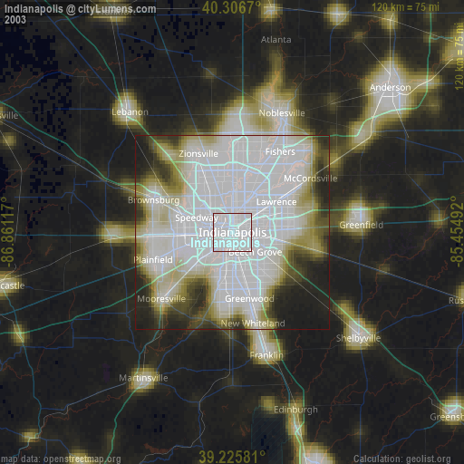
» NASA city lights 2003
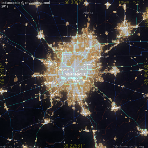
» Earth at Night: Flat Maps 2012, 2016