Garden City night lights from space
Night Light of Garden City (Kansas) from space (United States) Src. Average luminocity for 10x10km area is 41.901% and for 50x50km: 2.8233%.
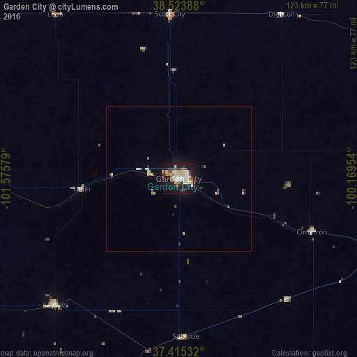
Analysis of Garden City night lights 2016
Square area 10x10 km:
 7.47%
7.47%90-99
7.14%80-89
8.12%70-79
6.01%60-69
3.9%50-59
4.87%40-49
2.76%30-39
5.68%20-29
8.28%10-19
37.34%0-9
8.44%Square area 50x50 km:
0.34%90-99
0.35%80-89
0.6%70-79
0.32%60-69
0.26%50-59
0.31%40-49
0.24%30-39
0.37%20-29
0.45%10-19
2.37%0-9
94.38%Clear (daylight) street map image can be seen on geolist.org.
Map coordinates:
38° 31' 26" North, 101° 34' 32.8" West
37° 58' 18.1" North, 100° 52' 21.6" West
37° 24' 55.2" North, 100° 10' 10.3" West
Some cities around Garden City sort by population:
• Dodge City
78.9 km =49 mi,  107°
107°
• Hays
168.3 km =104.6 mi,  53°
53°
• Liberal
103.3 km =64.2 mi,  182°
182°
• Guymon
153.1 km =95.1 mi,  200°
200°
• Perryton
174.9 km =108.7 mi, 177°
• Lamar
153.6 km =95.4 mi,  274°
274°
• Ulysses
60.7 km =37.7 mi,  224°
224°
• Colby
159.1 km =98.9 mi,  354°
354°
5445439 (p: 27,005)
Sources (retrieved 2019-11-25):
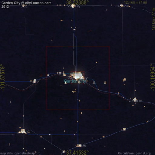
» Earth at Night: Flat Maps 2012, 2016