Shelbyville night lights from space
Night Light of Shelbyville (Indiana) from space (United States) Src. Average luminocity for 10x10km area is 33.3425% and for 50x50km: 10.3975%.
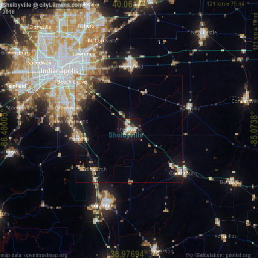
Analysis of Shelbyville night lights 2016
Square area 10x10 km:
 7.31%
7.31%90-99
6.01%80-89
4.22%70-79
1.79%60-69
3.41%50-59
3.57%40-49
2.92%30-39
4.22%20-29
7.14%10-19
40.75%0-9
18.67%Square area 50x50 km:
0.97%90-99
1.3%80-89
1.47%70-79
1.63%60-69
1.78%50-59
1.32%40-49
1.57%30-39
1.77%20-29
2.57%10-19
7.35%0-9
78.29%Clear (daylight) street map image can be seen on geolist.org.
Map coordinates:
40° 3' 42.1" North, 86° 28' 48.2" West
39° 31' 17.2" North, 85° 46' 36.9" West
38° 58' 37" North, 85° 4' 25.7" West
Some cities around Shelbyville sort by population:
• Greenwood
30.1 km =18.7 mi,  289°
289°
• Franklin
24.3 km =15.1 mi,  259°
259°
• Greenfield
29.3 km =18.2 mi,  1°
1°
• Greensburg
32.5 km =20.2 mi,  129°
129°
• Bargersville
33.5 km =20.8 mi,  269°
269°
• Rushville
30 km =18.6 mi,  70°
70°
• New Whiteland
27.6 km =17.1 mi,  278°
278°
• Cumberland
32.3 km =20.1 mi,  331°
331°
4264688 (p: 19,133)
Sources (retrieved 2019-11-25):
» Earth at Night: Flat Maps 2012, 2016