Fort Lee night lights from space
Night Light of Fort Lee (Virginia) from space (United States) Src. Average luminocity for 10x10km area is 65.1753% and for 50x50km: 38.3953%.
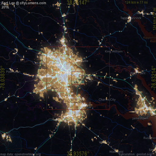
Analysis of Fort Lee night lights 2016
Square area 10x10 km:
 8.28%
8.28%90-99
10.88%80-89
9.25%70-79
19.32%60-69
11.53%50-59
14.29%40-49
12.99%30-39
6.98%20-29
5.03%10-19
1.46%0-9
0%Square area 50x50 km:
7.09%90-99
6.69%80-89
4.79%70-79
7.64%60-69
9.06%50-59
6.75%40-49
3.76%30-39
3.82%20-29
5.07%10-19
6.38%0-9
38.95%Clear (daylight) street map image can be seen on geolist.org.
Map coordinates:
38° 3' 5.3" North, 78° 2' 18.2" West
37° 29' 44.5" North, 77° 20' 6.9" West
36° 56' 8.7" North, 76° 37' 55.7" West
Some cities around Fort Lee sort by population:
• Richmond
12.8 km =8 mi,  300°
300°
• Mechanicsville
13 km =8.1 mi,  345°
345°
• Highland Springs
5.6 km =3.5 mi,  6°
6°
• East Highland Park
11.4 km =7.1 mi,  326°
326°
• Montrose
4.7 km =2.9 mi,  306°
306°
• Sandston
3.5 km =2.2 mi,  29°
29°
• Bellwood
12.2 km =7.6 mi,  227°
227°
• Bensley
11 km =6.8 mi,  240°
240°
4759735 (p: 7,520)
Sources (retrieved 2019-11-25):
» Earth at Night: Flat Maps 2012, 2016