Richmond night lights from space
Night Light of Richmond (Virginia) from space (United States) Src. Average luminocity for 10x10km area is 96.5536% and for 50x50km: 43.2607%.
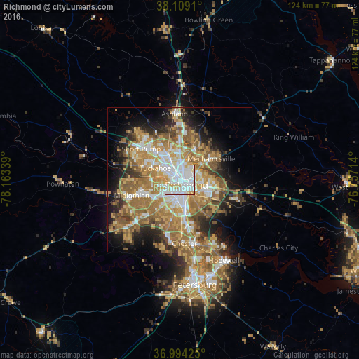
Analysis of Richmond night lights 2016
Square area 10x10 km:
 52.27%
90-99
33.28%80-89
9.09%70-79
4.71%60-69
0.65%50-59
0%40-49
0%30-39
0%20-29
0%10-19
0%0-9
0%Square area 50x50 km:
7.2%90-99
6.91%80-89
5.81%70-79
8.27%60-69
10.17%50-59
8.36%40-49
4.43%30-39
4.83%20-29
6.44%10-19
10.18%0-9
27.41%Clear (daylight) street map image can be seen on geolist.org.
Map coordinates:
38° 6' 32.8" North, 78° 9' 48.2" West
37° 33' 13.5" North, 77° 27' 36.9" West
36° 59' 39.3" North, 76° 45' 25.7" West
Some cities around Richmond sort by population:
• Tuckahoe
9.4 km =5.8 mi,  295°
295°
• Mechanicsville
9.8 km =6.1 mi,  51°
51°
• Bon Air
9.2 km =5.7 mi,  249°
249°
• East Highland Park
5.6 km =3.5 mi,  57°
57°
• Lakeside
6.2 km =3.9 mi,  346°
346°
• Montrose
8.1 km =5 mi,  116°
116°
• Dumbarton
6.2 km =3.9 mi,  333°
333°
• Chamberlayne
8.6 km =5.3 mi,  19°
19°
4781708 (p: 220,289)
Sources (retrieved 2019-11-25):
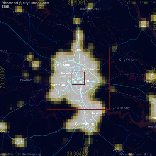
» NASA, Earths city lights 1995
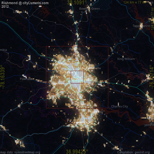
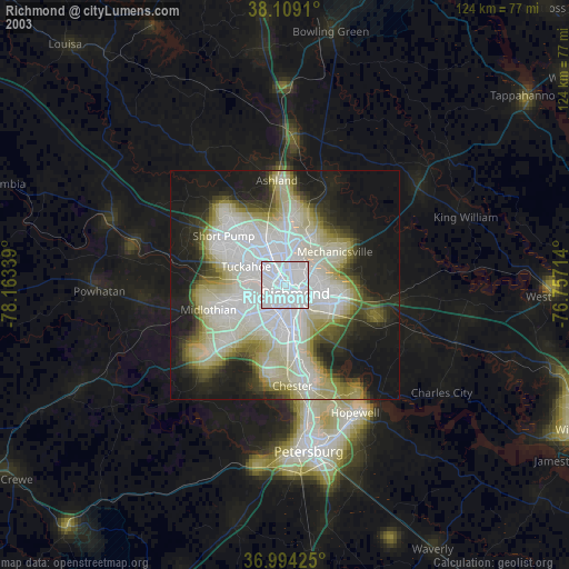
» NASA city lights 2003
» Earth at Night: Flat Maps 2012, 2016