Fairfield night lights from space
Night Light of Fairfield (California) from space (United States) Src. Average luminocity for 10x10km area is 52.6888% and for 50x50km: 18.1342%.
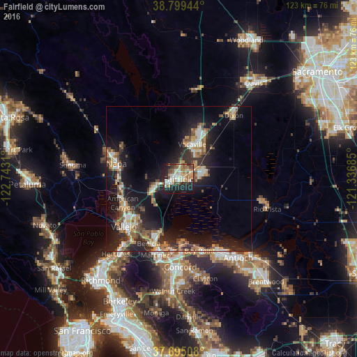
Analysis of Fairfield night lights 2016
Square area 10x10 km:
 9.69%
9.69%90-99
9.86%80-89
7.82%70-79
6.97%60-69
11.05%50-59
5.61%40-49
6.46%30-39
4.08%20-29
18.03%10-19
19.73%0-9
0.68%Square area 50x50 km:
2.38%90-99
2.34%80-89
1.36%70-79
3.11%60-69
2.57%50-59
2.69%40-49
2.96%30-39
2.45%20-29
6.84%10-19
15.06%0-9
58.24%Clear (daylight) street map image can be seen on geolist.org.
Map coordinates:
38° 47' 58" North, 122° 44' 35.2" West
38° 14' 57.7" North, 122° 2' 23.9" West
37° 41' 42.3" North, 121° 20' 12.7" West
Some cities around Fairfield sort by population:
• Vallejo
24.9 km =15.5 mi,  229°
229°
• Vacaville
12.8 km =8 mi,  20°
20°
• Napa
22.1 km =13.7 mi,  283°
283°
• Martinez
26.9 km =16.7 mi,  197°
197°
• Benicia
24.5 km =15.2 mi,  205°
205°
• Suisun
1.2 km =0.7 mi,  181°
181°
• Bay Point
25.4 km =15.8 mi,  164°
164°
• American Canyon
21 km =13 mi,  246°
246°
5347335 (p: 112,970)
Sources (retrieved 2019-11-25):
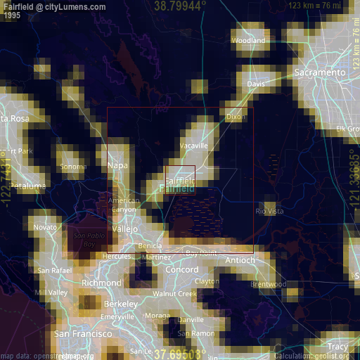
» NASA, Earths city lights 1995
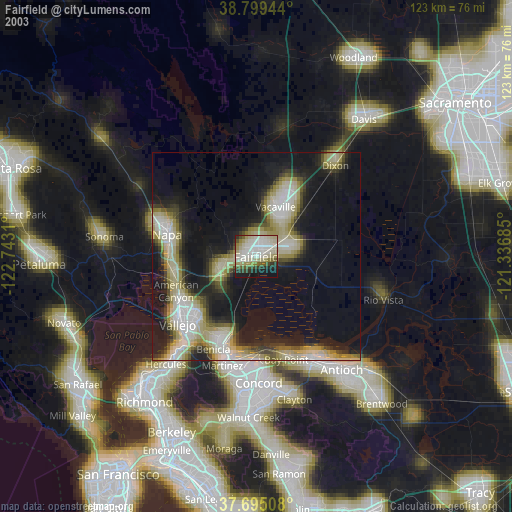
» NASA city lights 2003
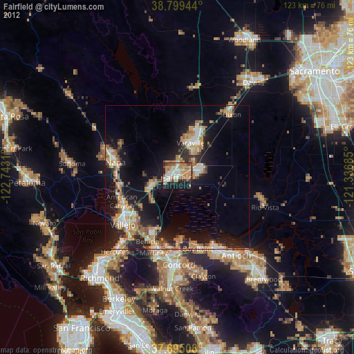
» Earth at Night: Flat Maps 2012, 2016