Vallejo night lights from space
Night Light of Vallejo (California) from space (United States) Src. Average luminocity for 10x10km area is 51.8701% and for 50x50km: 28.8875%.
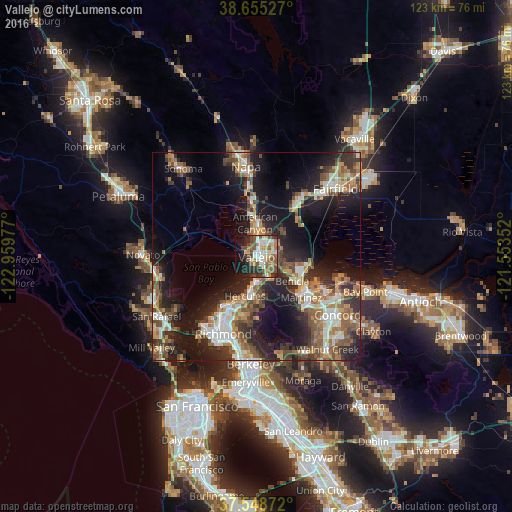
Analysis of Vallejo night lights 2016
Square area 10x10 km:
 10.39%
90-99
9.09%80-89
7.31%70-79
5.03%60-69
5.19%50-59
13.47%40-49
8.93%30-39
6.98%20-29
11.2%10-19
17.69%0-9
4.71%Square area 50x50 km:
4.23%90-99
4.25%80-89
2.07%70-79
4.13%60-69
4.8%50-59
5.37%40-49
5.41%30-39
4.9%20-29
9.22%10-19
17.3%0-9
38.33%Clear (daylight) street map image can be seen on geolist.org.
Map coordinates:
38° 39' 19" North, 122° 57' 35.2" West
38° 6' 14.7" North, 122° 15' 23.9" West
37° 32' 55.4" North, 121° 33' 12.7" West
Some cities around Vallejo sort by population:
• Martinez
14.3 km =8.9 mi,  131°
131°
• Benicia
10.5 km =6.5 mi, 125°
• Hercules
10.1 km =6.3 mi,  196°
196°
• American Canyon
7.9 km =4.9 mi,  357°
357°
• Pinole
11.7 km =7.3 mi, 198°
• El Sobrante
14.5 km =9 mi,  193°
193°
• Rodeo
8 km =5 mi, 186°
• Tara Hills
13.4 km =8.3 mi, 203°
5405380 (p: 121,253)
Sources (retrieved 2019-11-25):
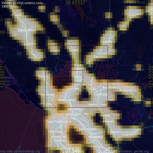
» NASA, Earths city lights 1995
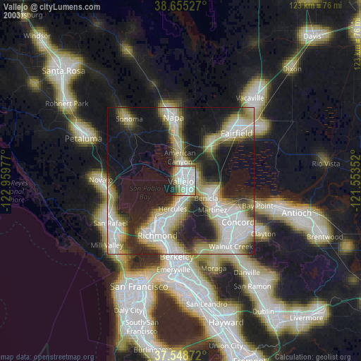
» NASA city lights 2003
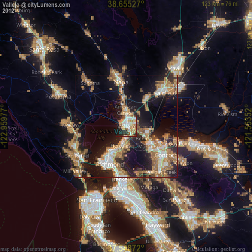
» Earth at Night: Flat Maps 2012, 2016