Erie night lights from space
Night Light of Erie (Pennsylvania) from space (United States) Src. Average luminocity for 10x10km area is 65.6348% and for 50x50km: 9.5038%.
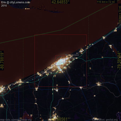
Analysis of Erie night lights 2016
Square area 10x10 km:
 24.09%
90-99
23.64%80-89
3.64%70-79
3.33%60-69
3.18%50-59
3.64%40-49
2.73%30-39
6.06%20-29
16.21%10-19
10.45%0-9
3.03%Square area 50x50 km:
1.52%90-99
1.91%80-89
0.84%70-79
0.8%60-69
1.28%50-59
1.49%40-49
1.44%30-39
1.22%20-29
2.72%10-19
5.18%0-9
81.59%Clear (daylight) street map image can be seen on geolist.org.
Map coordinates:
42° 38' 54.7" North, 80° 47' 17.5" West
42° 7' 45.2" North, 80° 5' 6.2" West
41° 36' 20.2" North, 79° 22' 55" West
Some cities around Erie sort by population:
• Jamestown
70.2 km =43.6 mi,  92°
92°
• Ashtabula
65.2 km =40.5 mi,  243°
243°
• Meadville
54.5 km =33.9 mi,  185°
185°
• Conneaut
43.7 km =27.2 mi, 242°
• Northwest Harborcreek
7.8 km =4.8 mi,  73°
73°
• Corry
43.5 km =27 mi,  122°
122°
• Edinboro
28.6 km =17.8 mi, 187°
• Titusville
65.4 km =40.6 mi,  148°
148°
5188843 (p: 99,475)
Sources (retrieved 2019-11-25):
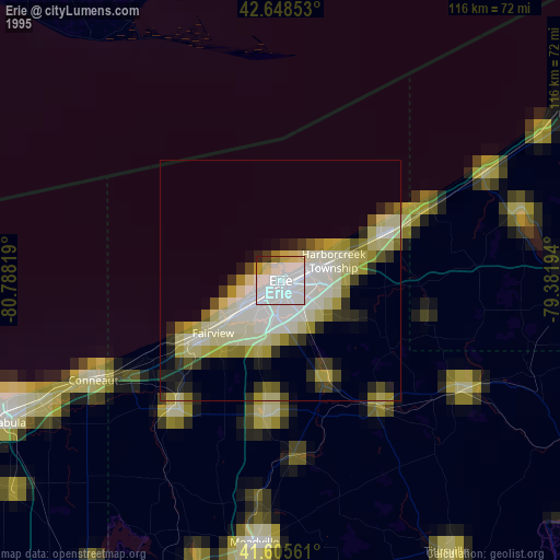
» NASA, Earths city lights 1995
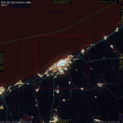
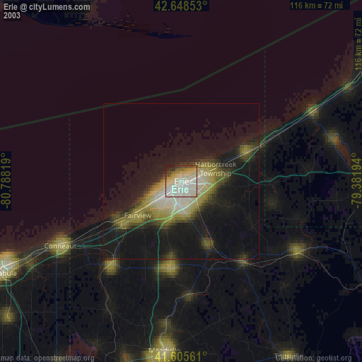
» NASA city lights 2003
» Earth at Night: Flat Maps 2012, 2016