Conneaut night lights from space
Night Light of Conneaut (Ohio) from space (United States) Src. Average luminocity for 10x10km area is 18.4921% and for 50x50km: 4.7482%.
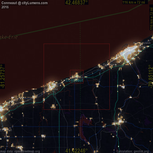
Analysis of Conneaut night lights 2016
Square area 10x10 km:
 0%
0%90-99
1.75%80-89
3.33%70-79
1.9%60-69
2.7%50-59
4.29%40-49
4.6%30-39
3.02%20-29
5.4%10-19
6.19%0-9
66.83%Square area 50x50 km:
0.29%90-99
0.48%80-89
0.79%70-79
0.45%60-69
0.7%50-59
0.82%40-49
0.76%30-39
0.75%20-29
1.22%10-19
3.16%0-9
90.57%Clear (daylight) street map image can be seen on geolist.org.
Map coordinates:
42° 28' 6.1" North, 81° 15' 26.5" West
41° 56' 51.2" North, 80° 33' 15.3" West
41° 25' 20.9" North, 79° 51' 4" West
Some cities around Conneaut sort by population:
• Erie
43.7 km =27.2 mi,  62°
62°
• Ashtabula
21.5 km =13.4 mi,  244°
244°
• Meadville
47.7 km =29.6 mi,  135°
135°
• Northwest Harborcreek
51.4 km =31.9 mi, 64°
• North Madison
44 km =27.3 mi,  248°
248°
• Edinboro
35.9 km =22.3 mi,  103°
103°
• Geneva
36.3 km =22.6 mi, 244°
• Chardon
61.7 km =38.3 mi,  233°
233°
5150986 (p: 12,712)
Sources (retrieved 2019-11-25):
» Earth at Night: Flat Maps 2012, 2016