Northwest Harborcreek night lights from space
Night Light of Northwest Harborcreek (Pennsylvania) from space (United States) Src. Average luminocity for 10x10km area is 45.9773% and for 50x50km: 9.2137%.
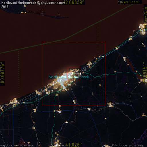
Analysis of Northwest Harborcreek night lights 2016
Square area 10x10 km:
 9.7%
9.7%90-99
9.85%80-89
3.79%70-79
3.33%60-69
6.36%50-59
6.52%40-49
11.52%30-39
2.73%20-29
14.24%10-19
22.12%0-9
9.85%Square area 50x50 km:
1.52%90-99
1.89%80-89
0.71%70-79
0.82%60-69
1.26%50-59
1.45%40-49
1.36%30-39
1.22%20-29
2.74%10-19
5.16%0-9
81.88%Clear (daylight) street map image can be seen on geolist.org.
Map coordinates:
42° 40' 6.9" North, 80° 41' 51.9" West
42° 8' 58" North, 79° 59' 40.7" West
41° 37' 33.6" North, 79° 17' 29.4" West
Some cities around Northwest Harborcreek sort by population:
• Erie
7.8 km =4.8 mi,  253°
253°
• Jamestown
62.9 km =39.1 mi,  95°
95°
• Meadville
58 km =36 mi,  192°
192°
• Conneaut
51.4 km =31.9 mi,  244°
244°
• Fredonia
63.4 km =39.4 mi,  59°
59°
• Corry
38.8 km =24.1 mi,  131°
131°
• Edinboro
32.6 km =20.3 mi,  200°
200°
• Titusville
63.9 km =39.7 mi,  155°
155°
7258393 (p: 8,949)
Sources (retrieved 2019-11-25):
» Earth at Night: Flat Maps 2012, 2016