Bryn Mawr-Skyway night lights from space
Night Light of Bryn Mawr-Skyway (Washington) from space (United States) Src. Average luminocity for 10x10km area is 89.4105% and for 50x50km: 41.185%.
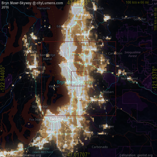
Analysis of Bryn Mawr-Skyway night lights 2016
Square area 10x10 km:
 44.18%
90-99
27.41%80-89
5.4%70-79
5.82%60-69
7.81%50-59
2.98%40-49
6.39%30-39
0%20-29
0%10-19
0%0-9
0%Square area 50x50 km:
11.83%90-99
9.8%80-89
3.56%70-79
4.66%60-69
5.44%50-59
4.29%40-49
4.64%30-39
5.61%20-29
6.45%10-19
8.73%0-9
34.98%Clear (daylight) street map image can be seen on geolist.org.
Map coordinates:
47° 58' 2" North, 122° 56' 38.6" West
47° 29' 39.5" North, 122° 14' 27.3" West
47° 1' 1.5" North, 121° 32' 16.1" West
Some cities around Bryn Mawr-Skyway sort by population:
• Renton
2.2 km =1.4 mi,  125°
125°
• Burien
8.4 km =5.2 mi,  251°
251°
• SeaTac
6.4 km =4 mi,  217°
217°
• Tukwila
2.7 km =1.7 mi,  213°
213°
• Fairwood
8.1 km =5 mi, 129°
• Newcastle
8.1 km =5 mi,  52°
52°
• Riverton
4.2 km =2.6 mi, 254°
• Boulevard Park
5.6 km =3.5 mi,  264°
264°
7260966 (p: 15,645)
Sources (retrieved 2019-11-25):
» Earth at Night: Flat Maps 2012, 2016