Dove Valley night lights from space
Night Light of Dove Valley (Colorado) from space (United States) Src. Average luminocity for 10x10km area is 84.6656% and for 50x50km: 46.3876%.
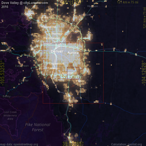
Analysis of Dove Valley night lights 2016
Square area 10x10 km:
 26.79%
90-99
23.54%80-89
7.63%70-79
17.05%60-69
22.24%50-59
2.76%40-49
0%30-39
0%20-29
0%10-19
0%0-9
0%Square area 50x50 km:
14.18%90-99
10.65%80-89
5.75%70-79
8.02%60-69
5.79%50-59
3.78%40-49
3.14%30-39
3.26%20-29
4.9%10-19
7.69%0-9
32.84%Clear (daylight) street map image can be seen on geolist.org.
Map coordinates:
40° 7' 3.1" North, 105° 31' 57.1" West
39° 34' 39.8" North, 104° 49' 45.8" West
39° 2' 1.1" North, 104° 7' 34.6" West
Some cities around Dove Valley sort by population:
• Centennial
4.1 km =2.5 mi,  272°
272°
• Parker
8.8 km =5.5 mi,  138°
138°
• Southglenn
10.6 km =6.6 mi,  275°
275°
• Castlewood
6.2 km =3.9 mi, 277°
• Greenwood Village
11.3 km =7 mi,  292°
292°
• Lone Tree
5.7 km =3.5 mi,  239°
239°
• Cherry Creek
7.8 km =4.8 mi,  324°
324°
• Stonegate
5.7 km =3.5 mi,  157°
157°
7729501 (p: 5,243)
Sources (retrieved 2019-11-25):
» Earth at Night: Flat Maps 2012, 2016