Centennial night lights from space
Night Light of Centennial (Colorado) from space (United States) Src. Average luminocity for 10x10km area is 87.7175% and for 50x50km: 49.9959%.
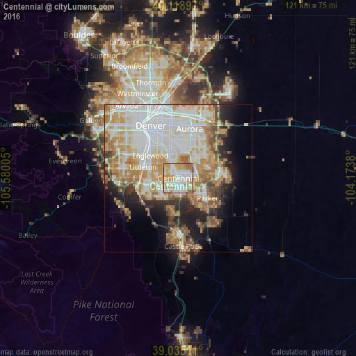

Analysis of Centennial night lights 2016
Square area 10x10 km:
 28.41%
90-99
26.62%80-89
10.06%70-79
24.84%60-69
8.77%50-59
1.3%40-49
0%30-39
0%20-29
0%10-19
0%0-9
0%Square area 50x50 km:
14.83%90-99
11.3%80-89
6.18%70-79
8.96%60-69
6.87%50-59
4.17%40-49
3.4%30-39
3.56%20-29
5.22%10-19
7.98%0-9
27.55%Clear (daylight) street map image can be seen on geolist.org.
Map coordinates:
40° 7' 8.3" North, 105° 34' 48.2" West
39° 34' 45" North, 104° 52' 36.9" West
39° 2' 6.4" North, 104° 10' 25.7" West
Some cities around Centennial sort by population:
• Highlands Ranch
8.4 km =5.2 mi,  250°
250°
• Southglenn
6.6 km =4.1 mi,  277°
277°
• Castlewood
2.2 km =1.4 mi,  286°
286°
• Greenwood Village
7.6 km =4.7 mi,  303°
303°
• Lone Tree
3.2 km =2 mi,  194°
194°
• Cherry Creek
6.2 km =3.9 mi,  355°
355°
• Stonegate
8.3 km =5.2 mi,  130°
130°
• Dove Valley
4.1 km =2.5 mi,  92°
92°
5416541 (p: 109,741)
Sources (retrieved 2019-11-25):
» NASA, Earths city lights 1995
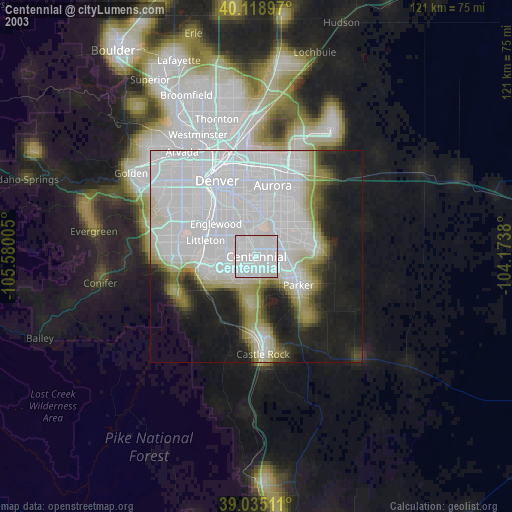
» NASA city lights 2003
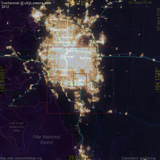
» Earth at Night: Flat Maps 2012, 2016