Parker night lights from space
Night Light of Parker (Colorado) from space (United States) Src. Average luminocity for 10x10km area is 57.2159% and for 50x50km: 33.0872%.
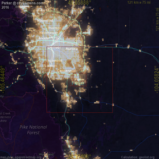
Analysis of Parker night lights 2016
Square area 10x10 km:
 5.36%
5.36%90-99
6.33%80-89
9.25%70-79
10.71%60-69
15.26%50-59
12.66%40-49
14.45%30-39
12.34%20-29
10.23%10-19
3.41%0-9
0%Square area 50x50 km:
8.54%90-99
7.39%80-89
3.78%70-79
6.26%60-69
4.72%50-59
3.3%40-49
2.78%30-39
2.83%20-29
4.13%10-19
7.05%0-9
49.21%Clear (daylight) street map image can be seen on geolist.org.
Map coordinates:
40° 3' 32" North, 105° 27' 52.2" West
39° 31' 7" North, 104° 45' 40.9" West
38° 58' 26.7" North, 104° 3' 29.7" West
Some cities around Parker sort by population:
• Centennial
12 km =7.5 mi,  304°
304°
• Castlewood
14.1 km =8.8 mi, 301°
• Lone Tree
11.3 km =7 mi,  288°
288°
• Cherry Creek
16.6 km =10.3 mi,  321°
321°
• The Pinery
7.4 km =4.6 mi,  161°
161°
• Castle Pines North
12.6 km =7.8 mi,  245°
245°
• Stonegate
3.9 km =2.4 mi, 290°
• Dove Valley
8.8 km =5.5 mi, 318°
5434006 (p: 49,550)
Sources (retrieved 2019-11-25):
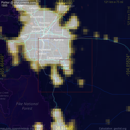
» NASA, Earths city lights 1995
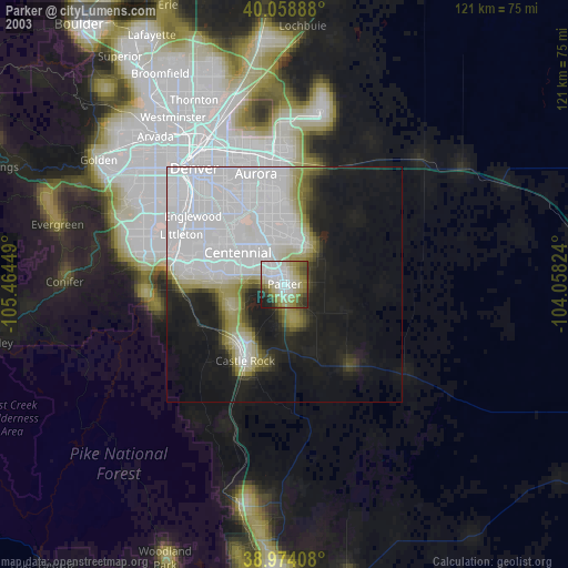
» NASA city lights 2003
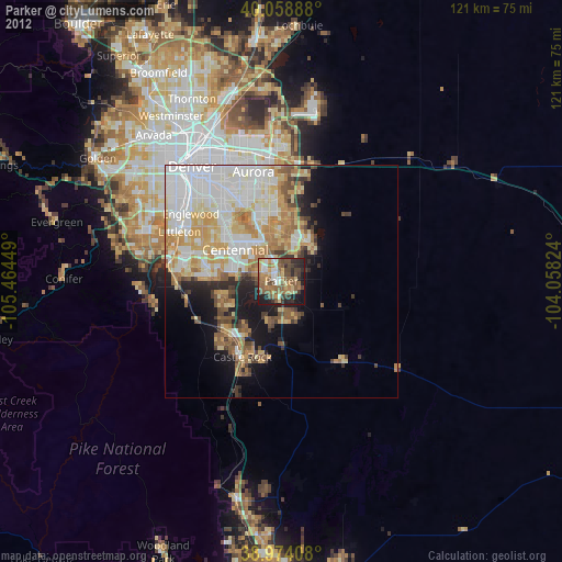
» Earth at Night: Flat Maps 2012, 2016