Discovery Bay night lights from space
Night Light of Discovery Bay (California) from space (United States) Src. Average luminocity for 10x10km area is 18.0828% and for 50x50km: 19.175%.
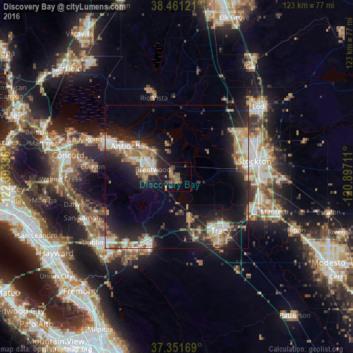
Analysis of Discovery Bay night lights 2016
Square area 10x10 km:
 0%
0%90-99
0%80-89
0%70-79
5.03%60-69
3.57%50-59
3.57%40-49
6.49%30-39
3.57%20-29
3.73%10-19
19.32%0-9
54.71%Square area 50x50 km:
2.61%90-99
3.19%80-89
1.35%70-79
3.19%60-69
2.67%50-59
2.76%40-49
2.67%30-39
2.64%20-29
6.59%10-19
14.07%0-9
58.24%Clear (daylight) street map image can be seen on geolist.org.
Map coordinates:
38° 27' 40.4" North, 122° 18' 12.1" West
37° 54' 30.7" North, 121° 36' 0.8" West
37° 21' 6.1" North, 120° 53' 49.6" West
Some cities around Discovery Bay sort by population:
• Stockton
27.7 km =17.2 mi,  78°
78°
• Antioch
21 km =13 mi,  300°
300°
• Tracy
24.2 km =15 mi,  140°
140°
• Pittsburg
28.3 km =17.6 mi, 298°
• Brentwood
8.8 km =5.5 mi,  287°
287°
• Oakley
13.9 km =8.6 mi,  315°
315°
• Mountain House
14.8 km =9.2 mi,  160°
160°
• Country Club
23.7 km =14.7 mi,  73°
73°
5343202 (p: 13,352)
Sources (retrieved 2019-11-25):
» Earth at Night: Flat Maps 2012, 2016