Country Club night lights from space
Night Light of Country Club (California) from space (United States) Src. Average luminocity for 10x10km area is 66.0682% and for 50x50km: 22.6034%.
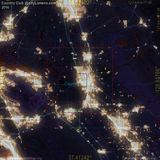
Analysis of Country Club night lights 2016
Square area 10x10 km:
 20.13%
90-99
22.4%80-89
6.82%70-79
4.71%60-69
5.68%50-59
8.12%40-49
4.38%30-39
2.44%20-29
7.79%10-19
13.64%0-9
3.9%Square area 50x50 km:
3.96%90-99
4.05%80-89
1.5%70-79
3.95%60-69
2.97%50-59
2.84%40-49
3.35%30-39
3.86%20-29
6.53%10-19
11.85%0-9
55.13%Clear (daylight) street map image can be seen on geolist.org.
Map coordinates:
38° 31' 15.7" North, 122° 2' 38.1" West
37° 58' 7.7" North, 121° 20' 26.8" West
37° 24' 44.7" North, 120° 38' 15.6" West
Some cities around Country Club sort by population:
• Stockton
4.6 km =2.9 mi,  105°
105°
• Tracy
26.5 km =16.5 mi,  196°
196°
• Manteca
22 km =13.7 mi,  150°
150°
• Lodi
18.9 km =11.7 mi,  18°
18°
• Lathrop
17.2 km =10.7 mi,  160°
160°
• Discovery Bay
23.7 km =14.7 mi,  253°
253°
• Garden Acres
9.8 km =6.1 mi,  93°
93°
• August
7 km =4.3 mi,  80°
80°
5340066 (p: 9,379)
Sources (retrieved 2019-11-25):
» Earth at Night: Flat Maps 2012, 2016